
Rainy Seasons
Over the past five years, Hodeidah governorate has seen rising rainfall levels, peaking in August 2022 with 133.65 cubic millimeters recorded — a rainfall event that produced a humanitarian disaster no less severe than in other years.
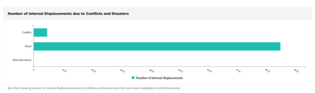
Hodeidah in the Path of the Floods
This year, specifically on August 6, 2024, the governorate was hit by catastrophic floods and torrential rains. According to mapping data prepared by the team, the affected and flooded area reached approximately 485 square kilometers, and the floods forced an estimated 150,000 to 170,000 residents to flee their homes.
Yemen's National Meteorological Authority recorded roughly 95.9 cubic millimeters of rainfall over Hodeidah governorate between 11:30 a.m. on August 6, 2024 and 11:30 a.m. on August 7, 2024. The floods were not caused by heavy rainfall over the governorate alone, but also by rain that fell across neighboring governorates, whose valleys and plains drained toward Hodeidah over the preceding two days.


Data from Yemen's National Meteorological Authority on rainfall volumes over Hodeidah governorate.
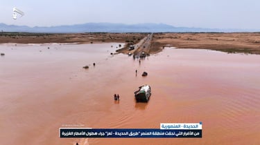
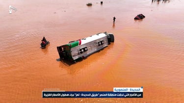
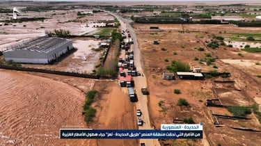
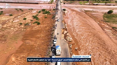
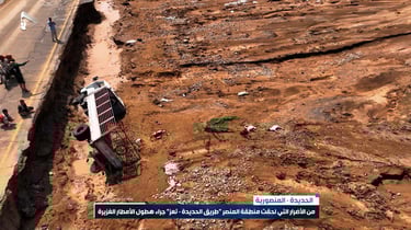
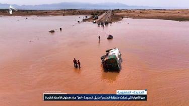
Widely circulated footage documenting the scale of the flooding in Hodeidah governorate, geolocated and verified against satellite imagery.
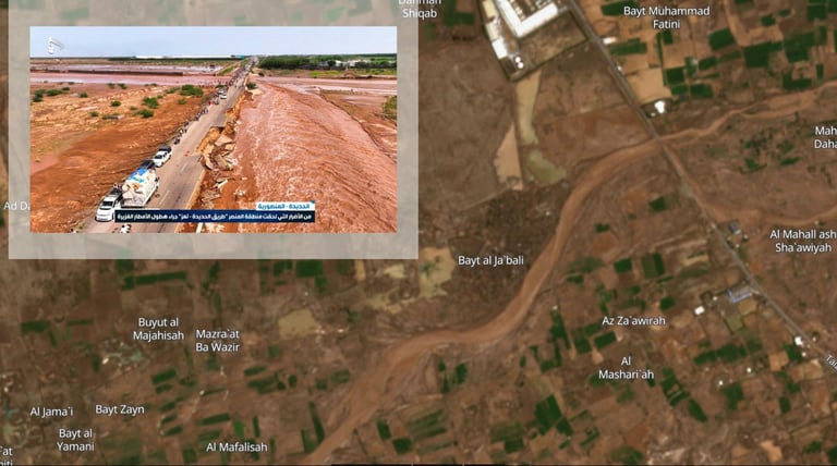
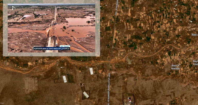
Hodeidah's city center was not the only area affected. Ansar Allah's media center also published photos of the Kassarah area in Zabid district, showing floodwaters cutting through the terrain — footage that matched satellite imagery of the same location.
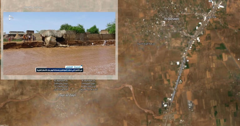
Al-Qanawis district was also affected by the raging floods, as shown in footage published by Ansar Allah's media center.
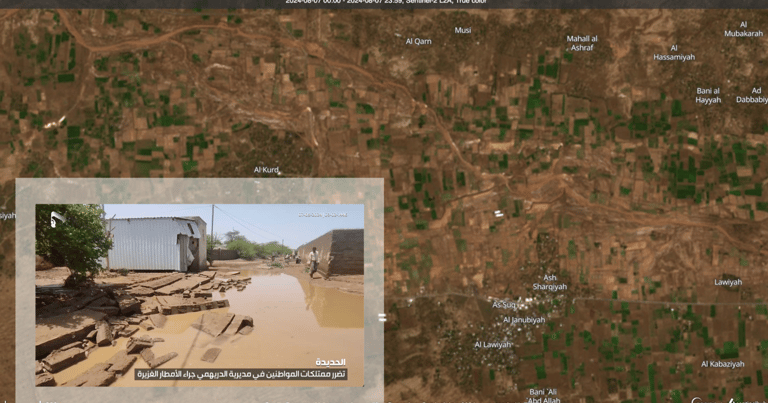
Al-Durayhimi district also sustained damage: bodies of water resulting from the floods could be observed in the village of Al-Lawiya, in the Al-Masa'eed sub-district, through satellite imagery and video footage that was likewise published by the media center.
After reviewing satellite imagery from August 7, 2024, the Nawa Media team identified an area known as "Mahal al-Bun" in Al-Durayhimi district, Hodeidah governorate, that had been completely submerged by floodwater. A sequence of satellite images captured the erosion of the area caused by the floods that struck the governorate on the night of August 6, 2024.
Impact on Farmland
Returning to the visual material circulating from the night of the disaster in Hodeidah, extensive farmland appeared affected — either washed away by the floods or submerged entirely. Media outlets and social media users also shared footage of trees that had been uprooted. The scale of the impact becomes clearer when considering that Hodeidah is one of Yemen's most important governorates for food production, effectively serving as the country's breadbasket.
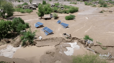

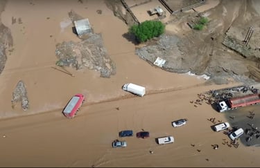
Footage documenting the impact of the floods on farmland in Hodeidah governorate.
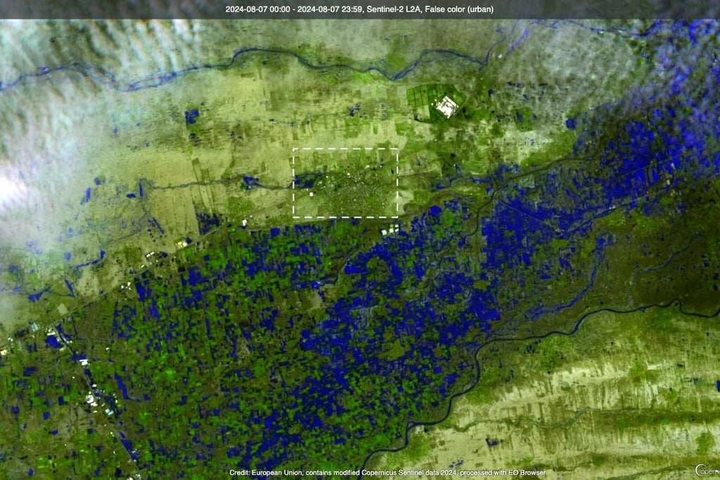
Comparing agricultural areas using satellite imagery captured on August 7, 2024 makes the scale of the impact clear. The team compared imagery of part of Hodeidah governorate from a land-cover data map — with farmland marked in yellow — against a separate satellite image identifying areas submerged by floodwater in dark blue. The comparison indicates that the majority of agricultural areas had been submerged.
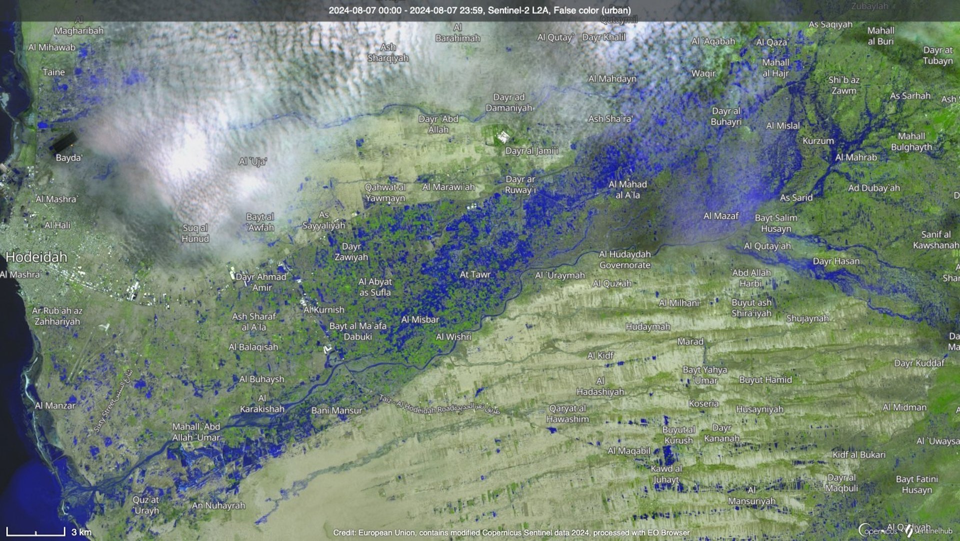
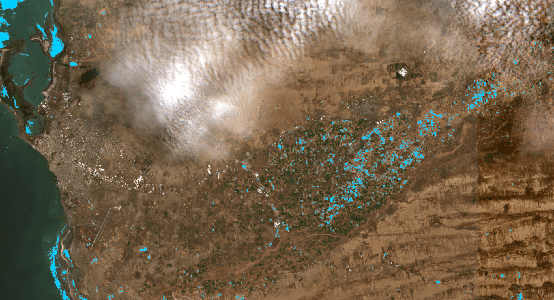
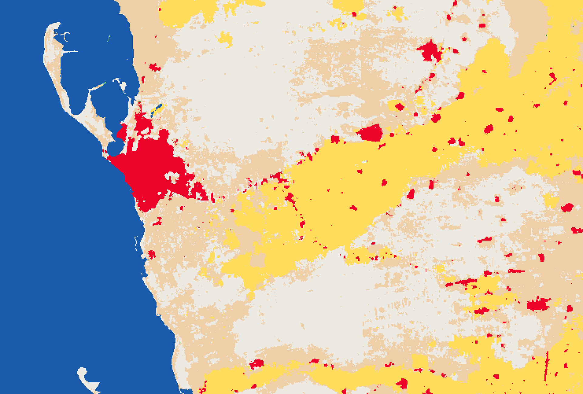
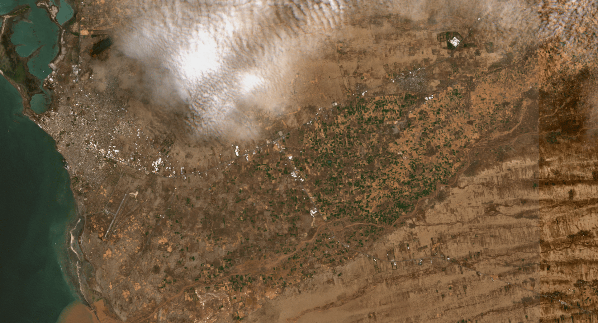
A comparison of satellite imagery of agricultural areas affected by the floods and rains in Hodeidah governorate on the night of August 6, against the team's analysis.
Waterborne Disease
The World Health Organization recently reported an outbreak of acute watery diarrhea and suspected cholera cases, noting that around 30,000 cases were recorded between January 1 and April 29, 2024 across all 22 of Yemen's governorates, with most concentrated in the northern regions.
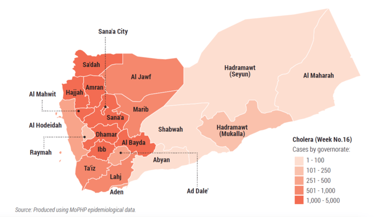
World Health Organization data on the spread of waterborne disease in Yemen.
Conclusion
Yemen's climate challenges are becoming starkly clear as environmental disasters and extreme weather events intensify — including flood damage in Al-Marawiah district, Hodeidah governorate, also identified through satellite imagery. Yet the country's ongoing political conflict appears to be obstructing the adaptation and risk-management plans essential to confronting these challenges. Yemen's climate outlook is alarming, underscoring the urgent need for effective action to mitigate these harms and to develop a sustainable strategy for adapting to climate change.