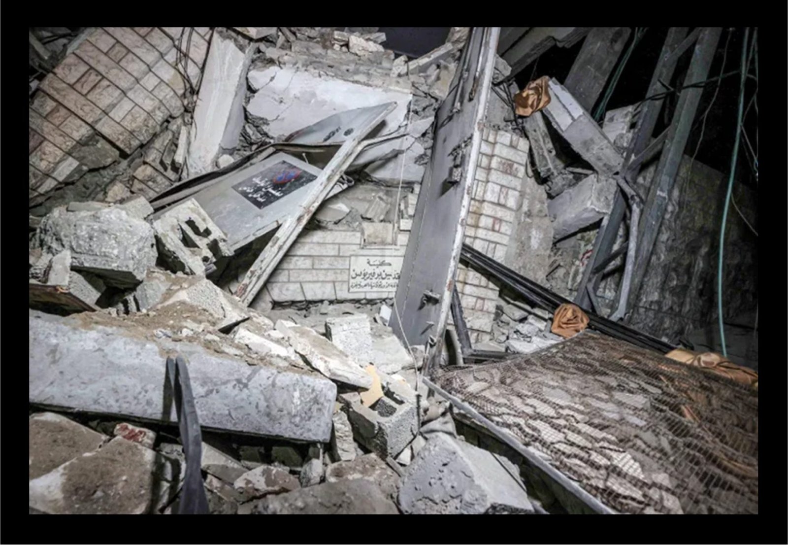
On October 19, 2023, several local and international news outlets and agencies reported an attack on the Church of Saint Porphyrius in the Al Zeitoun area of Gaza's Old City. The Greek-Orthodox Church of Saint Porphyrius has suffered damage during the continuous war between the Israeli state and Palestinian armed resistance groups.
Civilians who lived in the northern Gaza Strip used the church as a shelter during both the current war and the 2014 Gaza war, when almost 2,000 Palestinians took shelter in the church after fleeing Israeli shelling. The Israeli military claimed that a Hamas command and control center was struck and that it was located near the church, and posted a video showing the attack on a building.
1. What Happened?
On the evening of October 19, footage published online showed the location and remnants of the attack. The following day, Archbishop Alexios of the Saint Porphyrius Church claimed that the attack occurred at around 20:00 local time on October 19, adding that the structure that was attacked is one of the church's office buildings. Posts on X confirmed attacks near Kateb Wilaya Mosque on the same night at 21:38 local time in Gaza.

On October 20, Palestinian officials such as Salama Maarouf, head of the Palestinian government's media office, stated that the Israeli military committed a "crime" by targeting the Saint Porphyrius Church in Gaza and causing tens of casualties. Aerial views of the church's location show the exact building that appeared in media reports of the October 19 attack. Gaza's Old City includes several significant historical sites, such as the Saint Porphyrius church and the Kateb Wilaya Mosque.
2. Locating the Building Struck
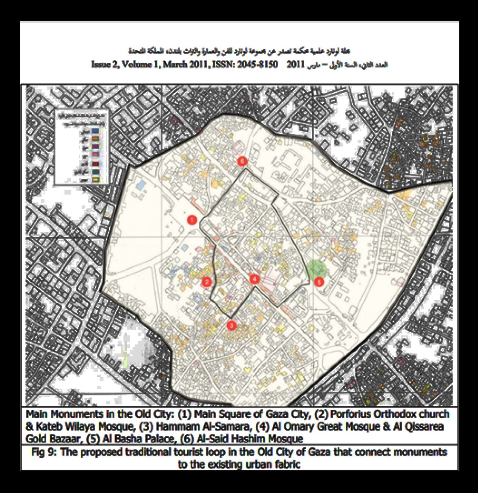
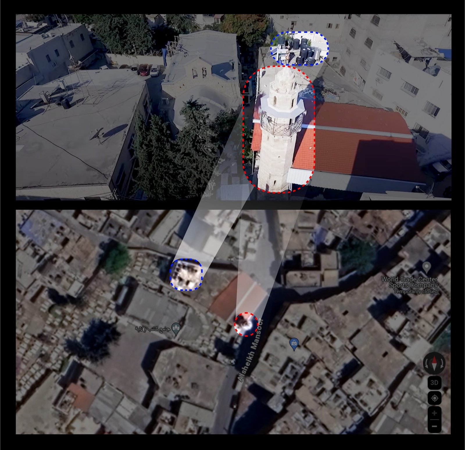
By comparing Google Earth images to footage in local news reports, the investigation team was able to locate the attacked building — aided by its architectural design and the tourist routes of distinctive places in Gaza's Old City. The building is misrepresented in maps available online, such as Google Earth, which required examining Arabic-language maps and reports from before the war began on October 7, 2023. The red-and-white church flag signifies the building's ownership by the Orthodox Patriarchate of Jerusalem.
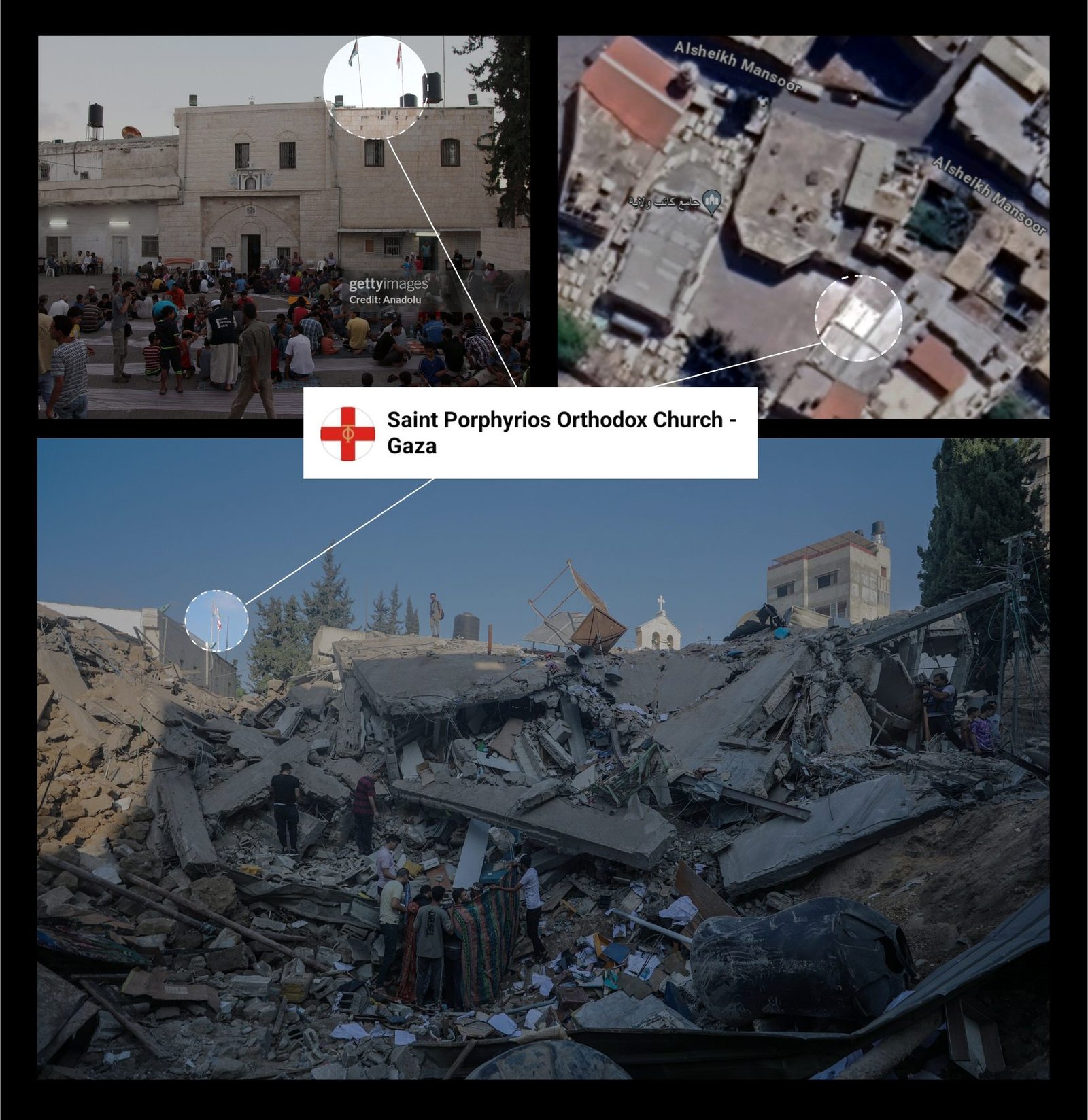
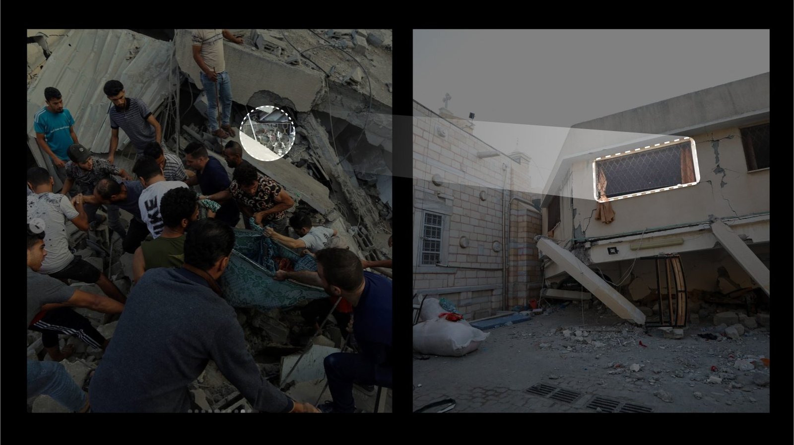
Images posted on Instagram of people rescuing others from under the rubble of the collapsed structure also revealed further details of the building. The Israeli military stated the airstrike hit a "command and control center belonging to a Hamas terrorist." A distinctively patterned window seen among the rubble matched the window frame of an adjacent building, indicating the two structures were interconnected and built in the same period — meaning it would be difficult for any entity other than the Holy Patriarchate to own, purchase, or build within the church compound.
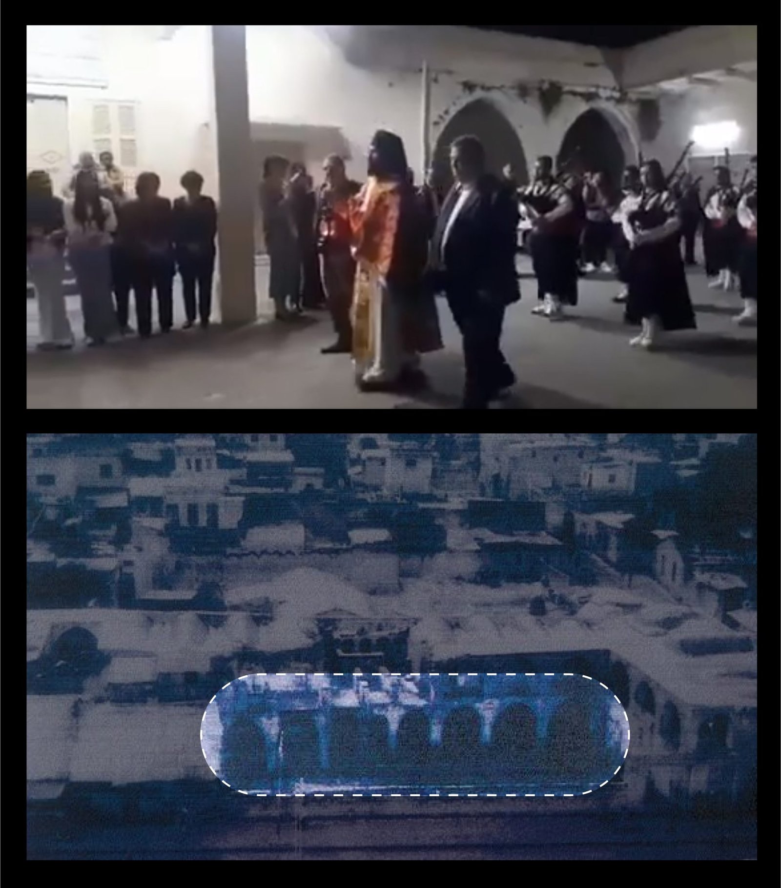
Above: Images of archaeological sites in Gaza's Old City — Khan al-Zait, the Old City, and the church (Source: Facebook, video of a ceremony). Below: Images of the attacked church compound buildings.
3. Impact Site
The architectural style of Gaza's Old City played a significant role in this investigation's analysis of the compound's structure — recalling the 1954 Hague Convention and its Protocols on protected buildings. Several buildings in the Old City share similarities because of the period they were constructed in; historical evidence shows that both the Kateb Al Wilaya area and Khan al Zait (demolished in the 1960s) were built during the 14th century, according to researchers.
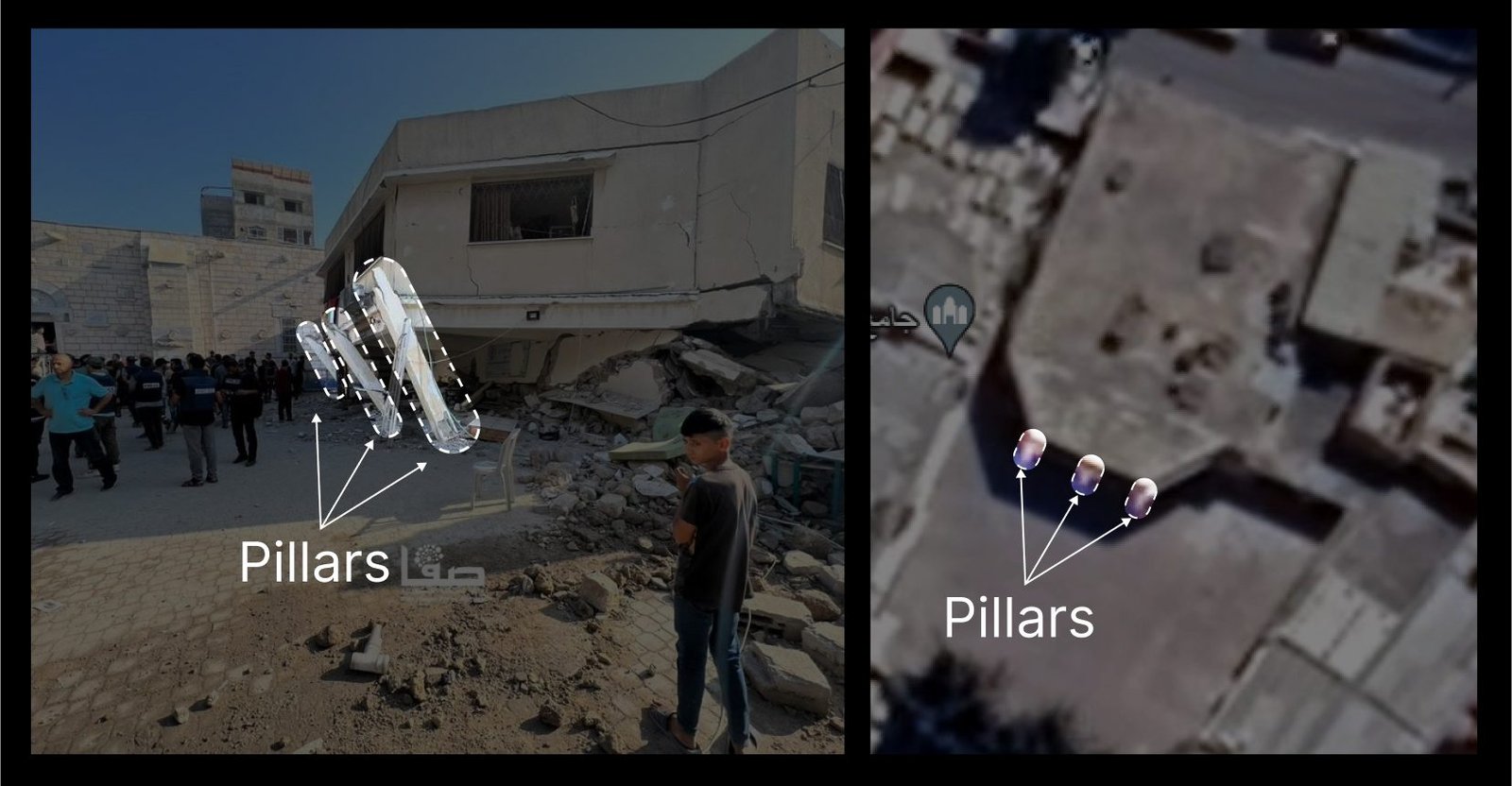
Archbishop Alexios, the bishop of the church, confirmed in an interview with Middle East Monitor that the Israeli military attacked the "offices of the church" that were being used as a shelter for people who had fled their homes, just as some church facilities were used as shelters during the 2014 Gaza war. Videos by YouTube vloggers describing the compound's structure — including a 360-degree view of the churchyard filmed before the 2023 war — helped locate the "assembly building" as one of several structures making up the church compound.
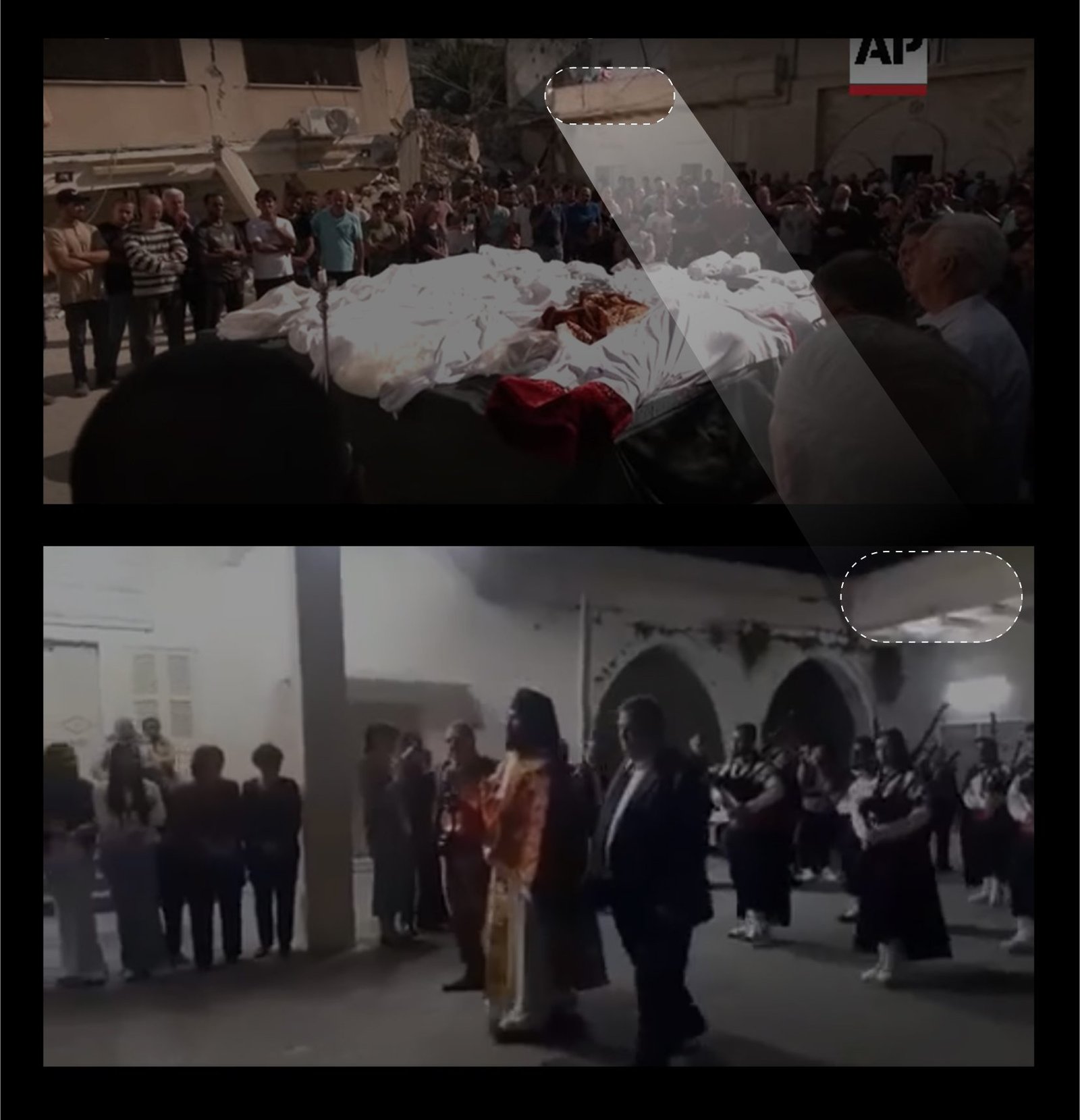
This information helped confirm the exact building destroyed: the strike took place between the assembly building (pillared) and the office (with the flag), with the damage varying between the two — the first severely damaged and leaning against one of the church walls, the other only partially damaged. The street-side corner also appears in a Reuters report, and the building in between was partially covered by tinplate that was shattered around the attack site.
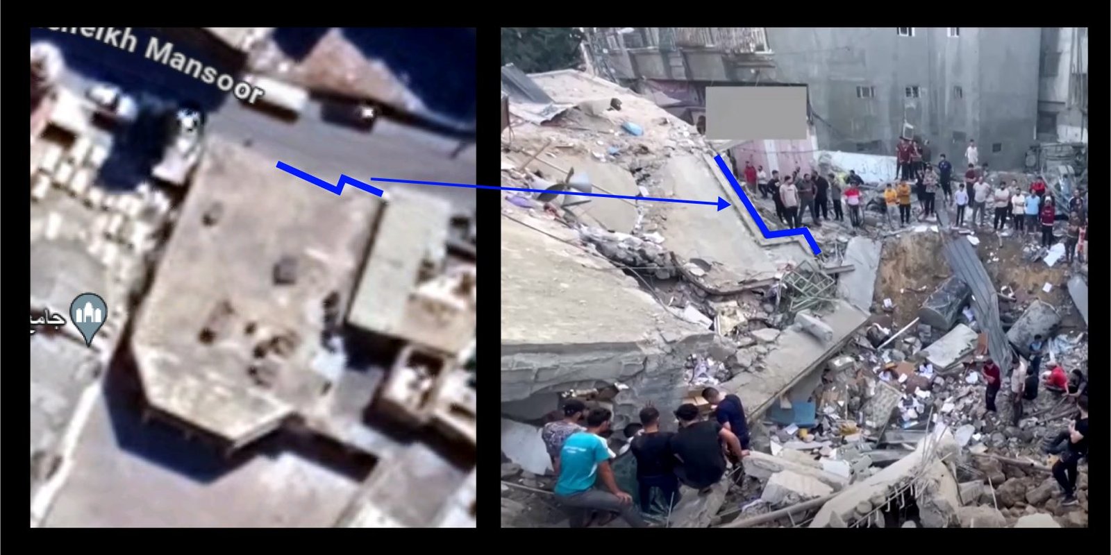
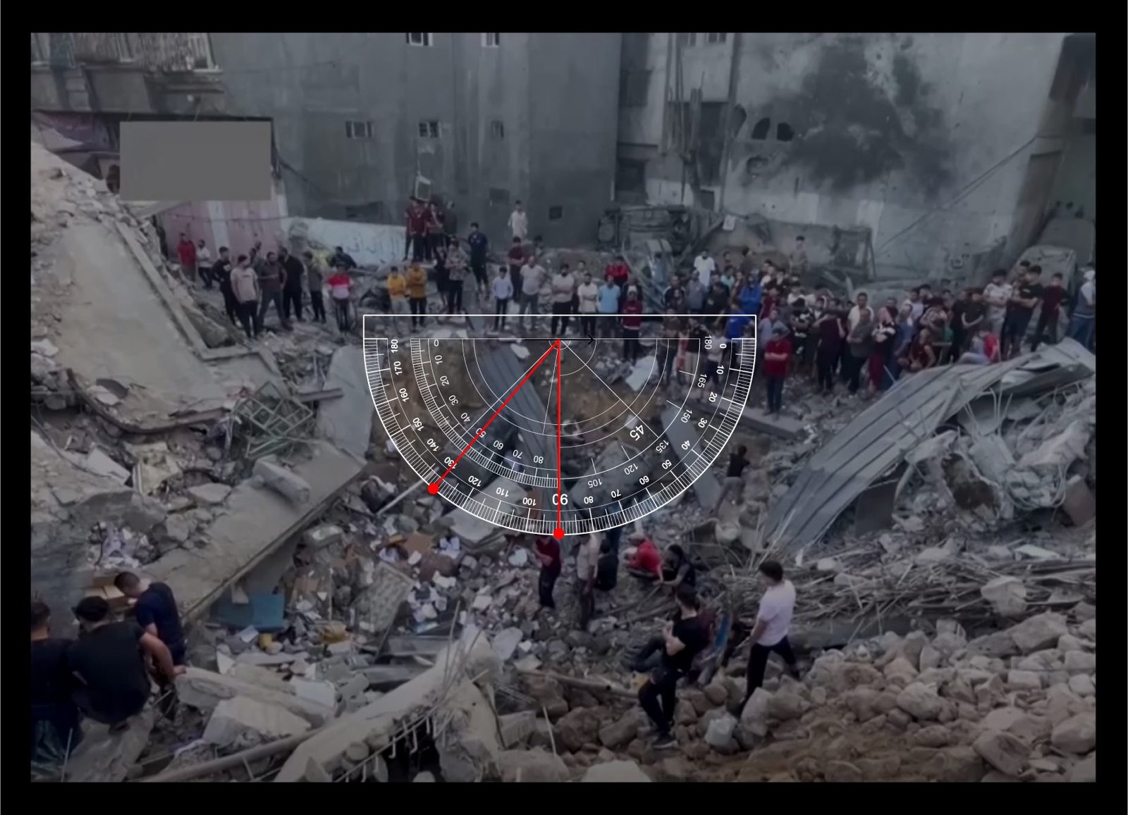
A comparison between the satellite image and a Reuters screenshot pinpointed the exact point of contact of the projectile used in the attack, while an online protractor tool was used to calculate the depth angle of the strike from the attack site.
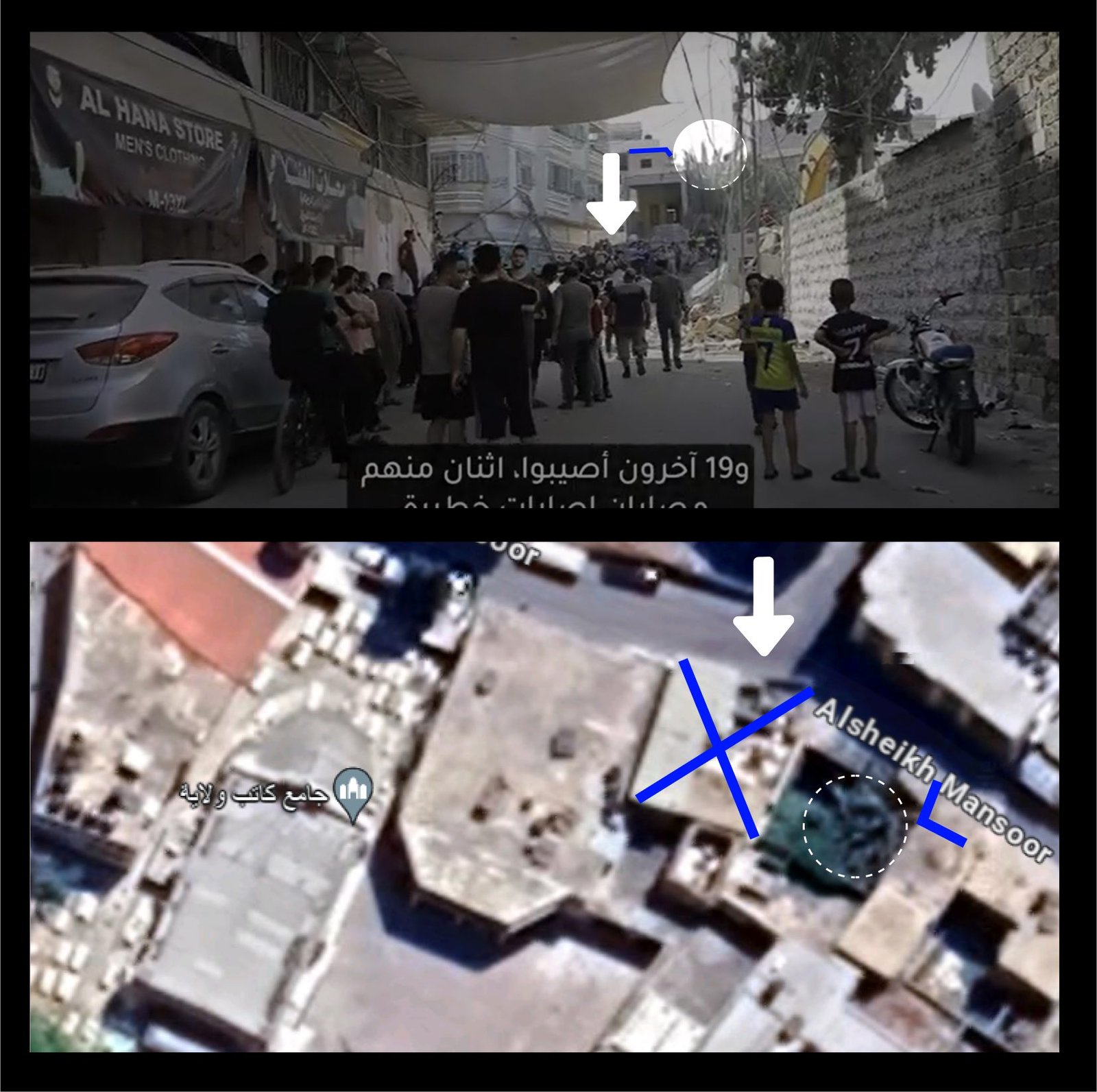
A video report showed a street view of Alsheikh Mansoor Street after the airstrike, revealing a tinplate-covered rooftop matching both the deleted Israeli military satellite video and the Reuters report. The trees in the building's yard survived intact, still visible next to the marked corner at the top of the building.
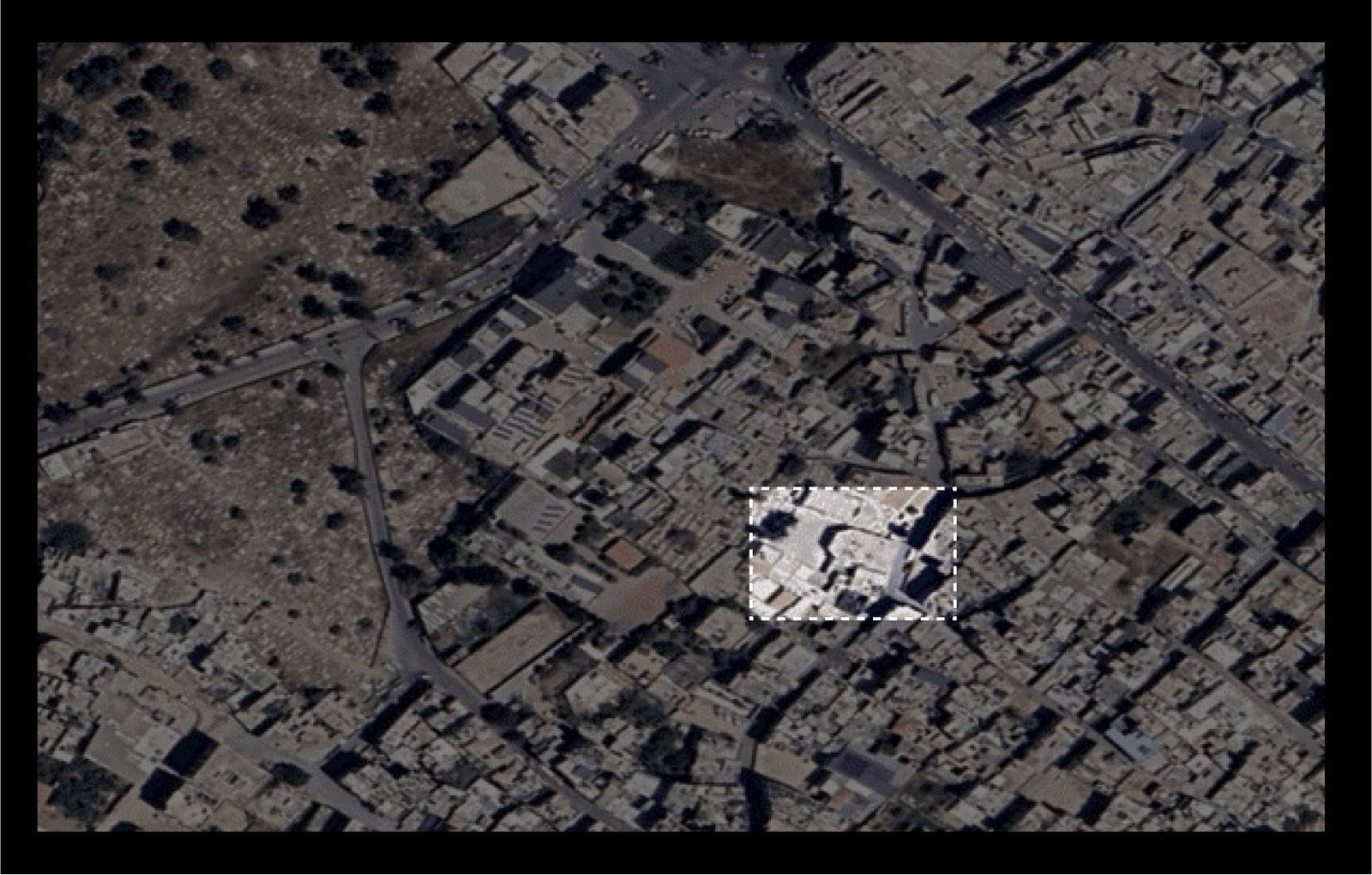
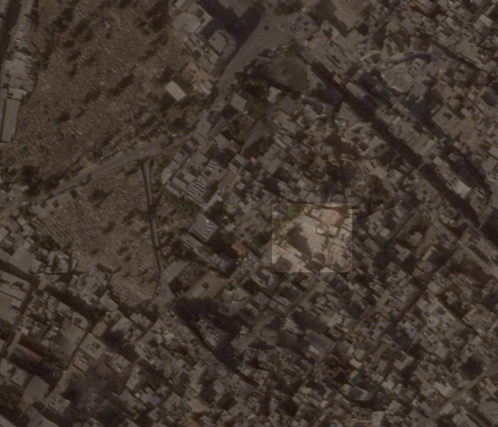
Satellite images showing the impact on the church compound. Before: May 13, 2022 (Google). After: October 29, 2023 (Planet Labs PBC).
4. Possible Responsibility
The Israeli military confirmed its attack on the church compound, not only verbally but also through its official social media accounts on X — though the post was deleted within hours. The Israeli military told CNN that "IDF fighter jets struck the command and control center belonging to a Hamas terrorist involved in the launching of rockets and mortars toward Israel," adding that "Hamas intentionally embeds its assets in civilian areas and uses the residents of the Gaza Strip as human shields."

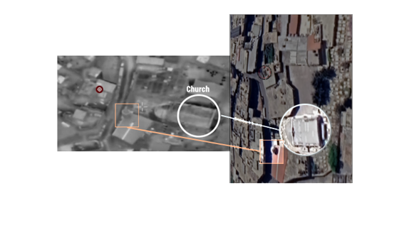
Above: the actually targeted building (red and black circle), Saint Porphyrius church (white circle), and the mosque minaret (orange square). Below: the mosque minaret (orange square), the impacted church buildings (blue), and the building the Israeli military claimed to be targeting (green).
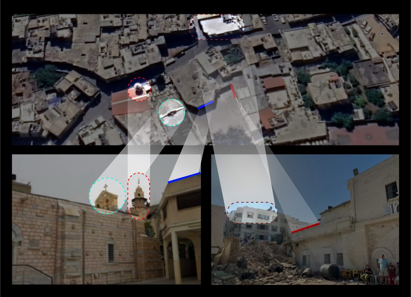
This investigation precisely determined the location of the strike within the church compound — disproving the Israeli military's claim that the target was a separate building set apart from the church.
It appears the Israeli military did not uphold its commitment to the precautions and principles stipulated in the 1954 Hague Convention for the Protection of Cultural Property in the Event of Armed Conflict, which prohibits assault against cultural properties. Article 57 of Additional Protocol I of the 1977 Geneva Conventions requires warring parties to take all feasible precautions in the choice of means and methods of attack to avoid, and in any event minimize, incidental loss of civilian life, injury to civilians, and damage to civilian objects.
After analyzing social media posts, reports, and testimonies from open-source data, the investigation team found no evidence that the Israeli military issued a warning to people who sought refuge in the Saint Porphyrius church, or to church workers, prior to the attack — and church workers emphasized that they had received no such warning. International humanitarian law requires "effective advance warning of attacks which may affect the civilian population, unless circumstances do not permit" — a standard the Israeli military does not appear to have met in this case.