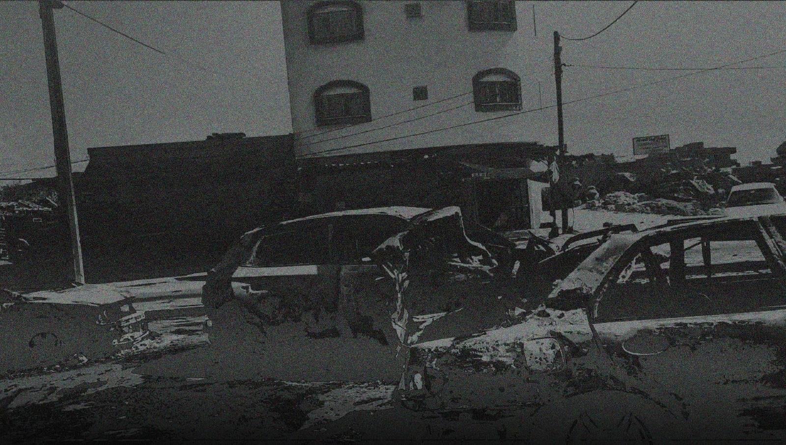
Evidence Contradicts Israel's Denial of Responsibility for Attack on Displaced Persons' Convoy in Gaza
An open-source investigation analyzing 32 visual sources to document multiple strikes on a civilian convoy of displaced people along Salah al-Din Street near Kuwait Roundabout in Gaza City, on the afternoon of Friday, October 13, 2023 — revealing a timing and location contradiction in the Israeli military's denial of responsibility.
Investigation Methodology
Videos and photographs from social media and news outlets, published on the day of the attack and over the following three days, were collected, preserved and analyzed — drawing on 32 sources across different media. The date and time of the attack were established using the open-source tool Invid, which extracts publication date and time through reverse engineering of the first post about the incident, alongside SunCalc, which determines timing based on the length and direction of shadows at the attack site.
Salah al-Din Street was geolocated by matching visible landmarks — shops and distinctive structures appearing in the visual content — against satellite imagery on Open Street Map, within a 4.6 km search radius around the attack area.
Identifying the likely responsible party relied on analyzing the trajectory of the munitions and the angles of penetration in the damaged vehicles, together with the location of recovered munition fragments, cross-referenced against information on which force controlled the area. This investigation is the product of analysis conducted by the NAWA Media open-source investigations team, and offers an understanding of the incident and its likely perpetrator, without constituting a definitive assessment by weapons experts.
The Gaza Strip has witnessed devastating attacks by the Israeli military since the start of October 2023. Convoys of displaced people have not been spared: one such convoy came under repeated attack along Salah al-Din Street near Kuwait Roundabout on the afternoon of Friday, October 13, 2023, while evacuating south at the Israeli military's own request.
The attacks killed 70 people and wounded more than 200 others. Through its official spokesperson, the Israeli military presented a narrative that used footage of a different incident — at a different location and time — to deny responsibility for the attack.

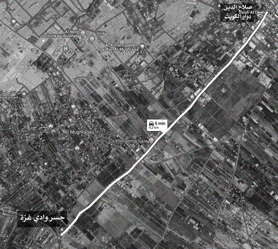
The Critical Discrepancy
Through its official spokesperson, the Israeli military presented footage of an explosion filmed at the Wadi Gaza bridge, roughly 4 kilometers from the Salah al-Din Street attack site. Shadow analysis of this footage indicates it was filmed at approximately 14:59 local Gaza time — while the first report of the Wadi Gaza bridge incident itself was published at 16:04, more than an hour after the footage was recorded.
By contrast, the earliest reports of the attacks on the displaced persons' convoy on Salah al-Din Street were published at 15:15. Scrutinizing this data makes clear that the Wadi Gaza bridge incident is entirely distinct from the multiple attacks that struck the convoy near Kuwait Roundabout — and the footage's use out of context led the Israeli military's spokesperson to deny responsibility for the attack.
Evacuation Order
On the morning of October 13, 2023, the Israeli military's account on X posted a warning to residents of northern Gaza, stating that civilians needed to evacuate their homes southward, moving to the area south of Wadi Gaza.
Screenshot of the Israeli military's announcement on October 13, 2023, at 8:50 a.m.
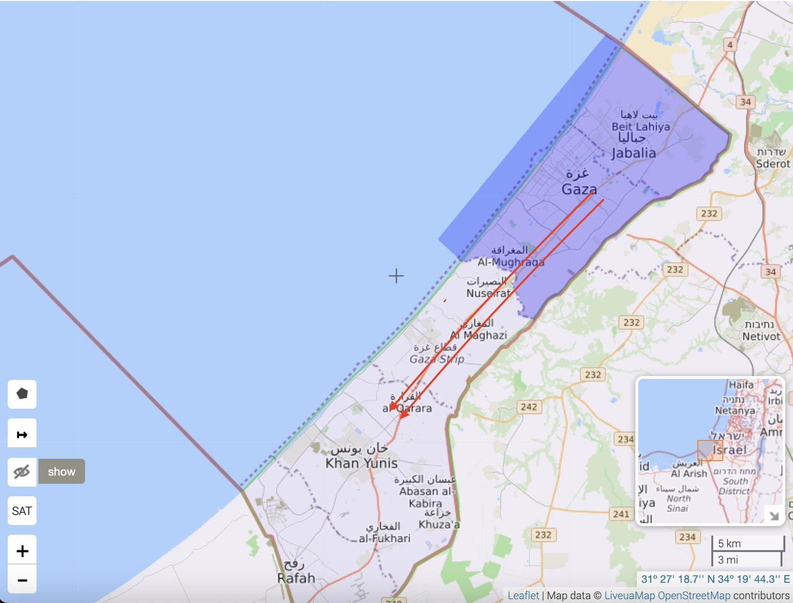
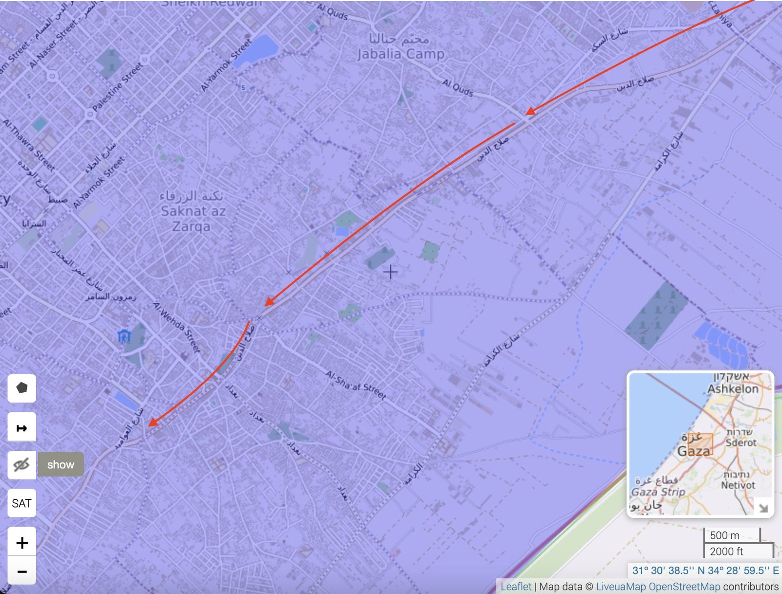
That same evening, Israeli military spokesperson Avichay Adraee shared an update to the evacuation announcement on his Facebook page, adding: "We called on you this morning to leave Gaza City for the area south of Wadi Gaza, for your own safety. I would like to inform you that the IDF will refrain from striking the route marked on the map until 20:00."
This was the only announcement available online that specified a designated route for the evacuation — Salah al-Din Street itself.
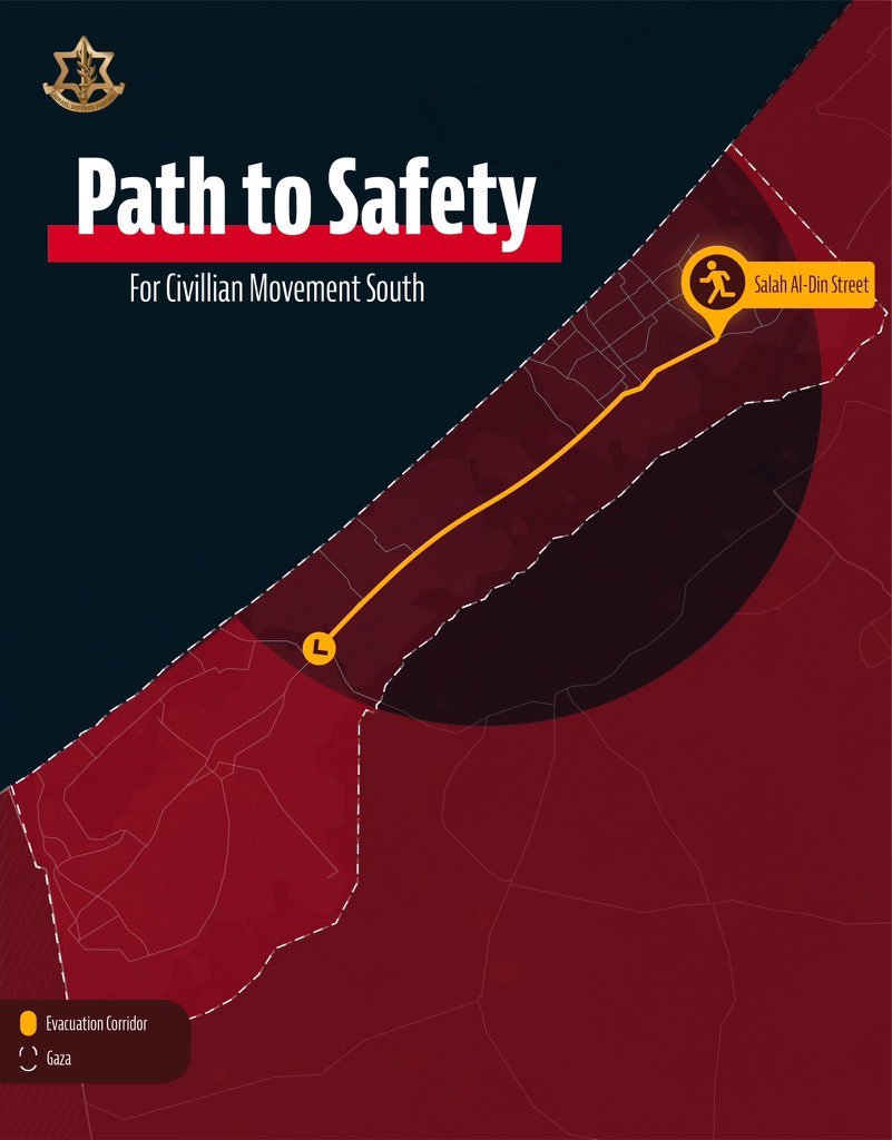
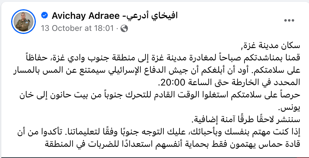
Adraee's post indicating that Salah al-Din Street was a safe evacuation route from the north to south of Wadi Gaza, from the morning until 8 p.m.
A frame from CBS Chicago footage of one of the leaflets dropped by Israeli aircraft over Gaza on October 13, carrying similar evacuation instructions.
What Happened
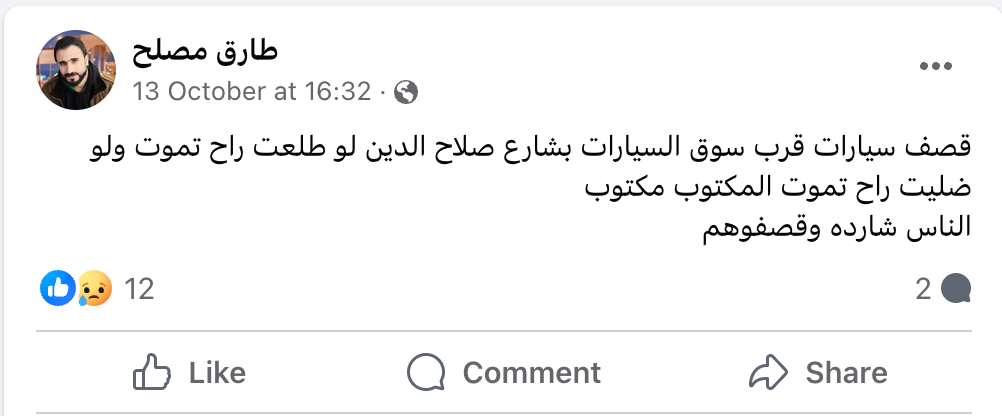
A user under the name "The Joker" posted on X at 15:15 Gaza time about a strike on a Mercedes full of civilians on Salah al-Din Street, in the middle of the Strip, as they attempted to head south. At 16:32, the account of Tariq Musleh posted: "Cars struck near the car market on Salah al-Din Street… people are fleeing and they're bombing them." At 16:55, an account under the name Nermeen asked: "What's happening in the Zeitoun neighborhood? Reports of massacres." According to this analysis, these three accounts were the first to report on the attack.


At 7:00 p.m. that same day, the Palestinian government's media office in Gaza issued an official statement on the Israeli military's shelling of a number of cars carrying displaced people heading south.
A video published by the Palestinian Ministry of Health/Gaza showed an ambulance driver, described as "a witness to a real massacre," collapsing to his knees on arrival at the hospital, saying: "Tell people to go home — they bombed people fleeing in trucks… they told people to flee, and then bombed them." Someone beside him added that the trucks and ambulances had also been struck.
Geolocation: Where Did the Attack Take Place?
By matching visual content from videos published by the Palestinian Ministry of Health/Gaza, journalist Ragıp Soylu, Local Focus, and other footage circulating online, the coordinates of several documented strikes could be established: one attack struck a group of cars behind the two-trailer truck, beside the Aslim petrol station on Salah al-Din Street near Kuwait Roundabout, at coordinates 31.483005, 34.444769.
Another attack, minutes later and meters away, struck a car in front of the Daghmash trading and tire-repair shops, next to an ambulance crew shortly after its arrival, at coordinates 31.483354, 34.445045. These cannot be confirmed as the only two strikes — the actual number of attacks may well have been considerably higher.

When Did the Attack Take Place?
Based on shadow movement using the SunCalc tool, and the chronology of damage from consecutive strikes as it appears across circulating videos, it was possible to sequence events and construct a probable scenario.
Journalist Khaled Iskif published a video filmed from the roof of a building near the attack site, showing two cars on fire with flames rising, and two more cars beside them whose damage wasn't visible. Comparing it with a video published by the Palestinian Ministry of Health/Gaza shows both were filmed at the same moment from two different angles; shadow analysis of one clip puts the filming time at approximately 15:45 ± 10 minutes, Gaza time.
The Ministry of Health published another video documenting three strikes only seconds apart — one a direct hit on a car parked beside the ambulance, injuring two crew members seen at the end of the earlier video: one with a leg injury, the other with a head wound. Shadow analysis puts this video at approximately 15:55 ± 10 minutes. The footage also shows the fire dying down on one of the two cars from Iskif's video while a new one — possibly the grey car — starts burning, suggesting an additional strike occurred between the two videos.

A third video, published by journalist Ragıp Soylu, appears to have been filmed some time after the strike on the ambulance crew: it shows the group of burning cars, with the one beside the ambulance now producing less smoke, its body discoloured, and its tires fully burnt. A body can be seen lying in the middle of the road, possibly hit by shrapnel from the projectile that fell beside the ambulance. Shadow analysis of one shot puts the filming time at approximately 17:20 ± 20 minutes, Gaza time.
These timings cannot be stated with certainty, given the imprecision of the captured shadow positions, but it can be concluded that the multiple attacks on the displaced persons' convoy on Salah al-Din Street near Kuwait Roundabout most likely occurred between 15:15 and 17:20 Gaza time, with one of those attacks documented as three strikes only seconds apart.
Impact of the Attack
Given the timeline and visual content, the shelling was likely indiscriminate fire along a single direction of Salah al-Din Street, with most strikes concentrated within an area of roughly 700 square meters.
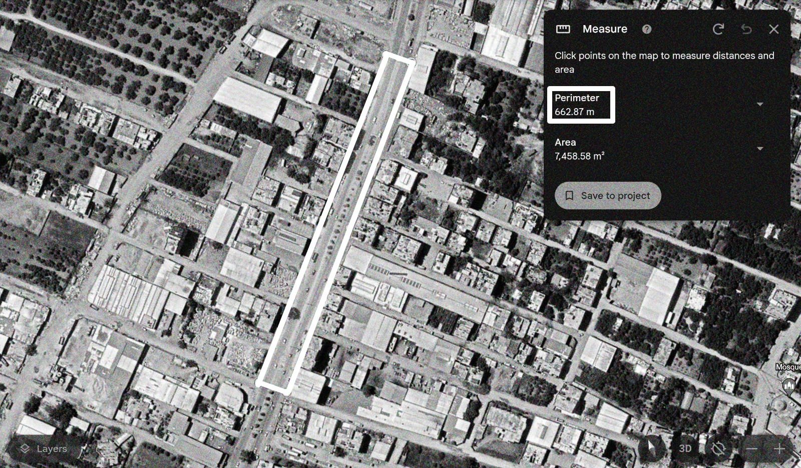
The shelling burned and destroyed 6 passenger vehicles, damaged a number of other parked cars, and damaged the ambulance struck by fragments from a munition that fell beside it. Seven civilian bodies were observed scattered along the street. The attack killed 70 people and wounded more than 200 others, according to Al Jazeera, citing the Palestinian Ministry of Health, which did not release the victims' names.

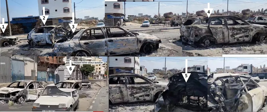
Frames from Forbes Breaking News footage and journalist Al-Zanoun's video, showing the number of shelled and burnt cars along the street. October 2023.
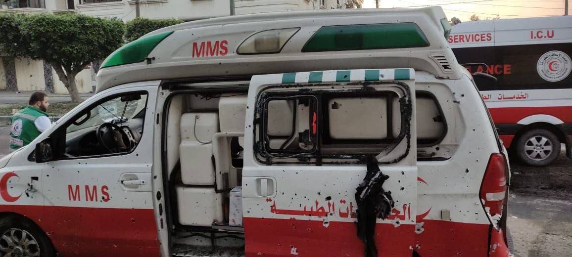
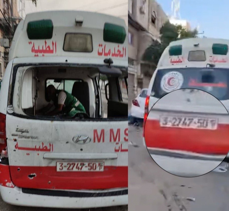
Images from the Quds News channel of the damaged ambulance; the vehicle's ID number matches the one seen in the Palestinian Ministry of Health/Gaza video.
Left: a frame from journalist Al-Zanoun's video showing munition remnants believed to be the tail fin of an 81mm mortar shell. Right: an image from the CATUXO website of an Israeli M43 81mm mortar shell of the same caliber. Images from October 2023.
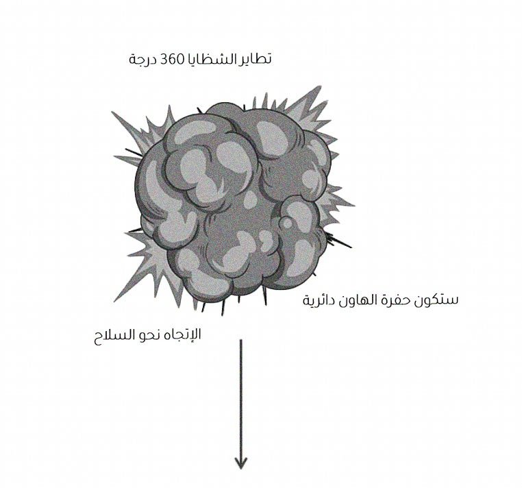
This type of munition typically detonates with 360-degree fragmentation — an effect visible in footage of the shelled cars and in the pattern of shrapnel scarring on the ambulance's wall.
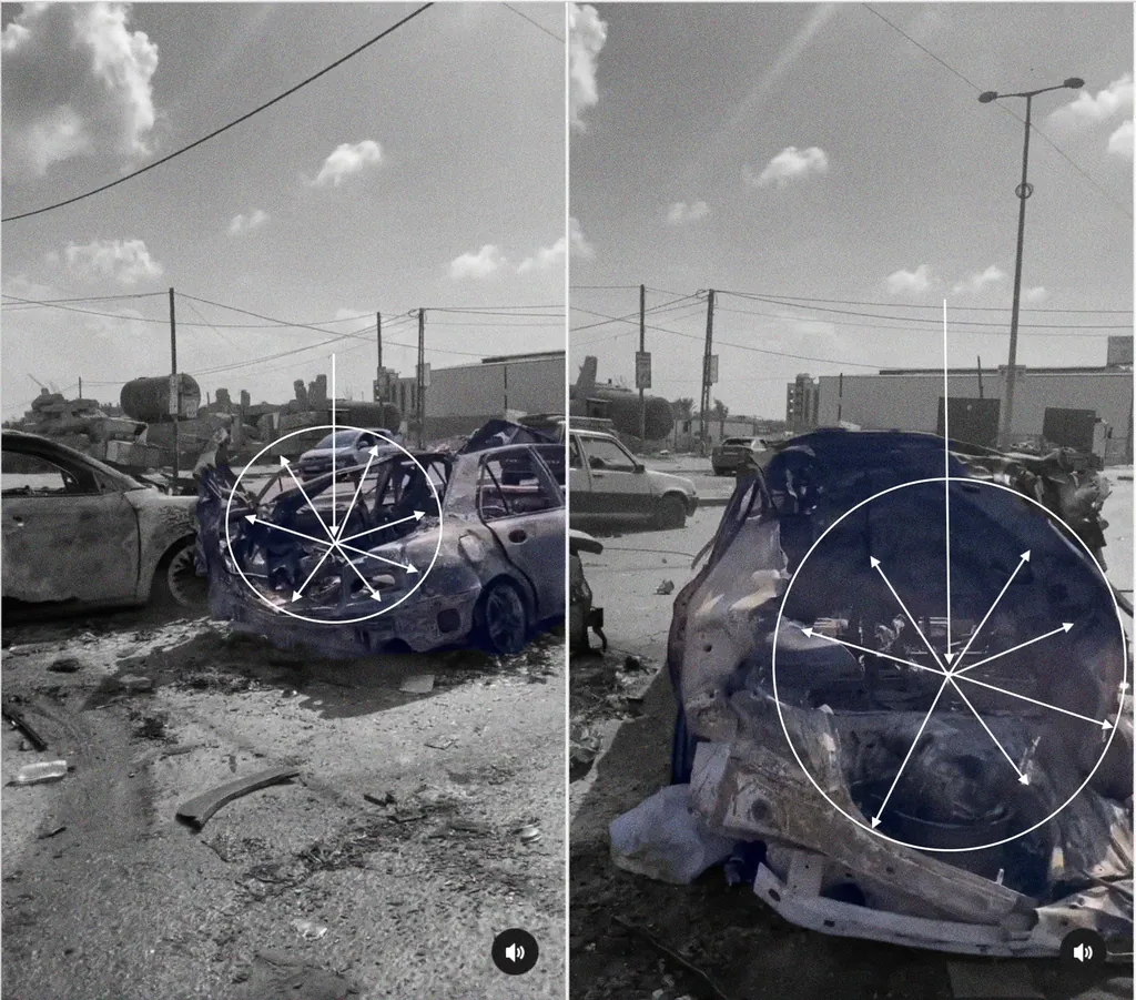
An image of the ambulance from the Quds News Telegram channel, showing the pattern of shrapnel scarring within its dispersion range. The circle and white arrows indicate the probable direction of shrapnel spread.
This analysis may also explain the damage to the rear trailer of the truck carrying displaced people, on its eastern side — blood stains and bodies were visible on it despite the absence of a direct hit, suggesting it was affected by fragments from a munition that fell at close range and was not directly observed. The effective range of 81mm mortar shrapnel typically extends to a circle roughly 20 meters in diameter.

Facebook user Mohammed Sirhan wrote that he was at the incident site during the shelling, in a taxi carrying a family from Gaza heading south, when the cars and displaced people walking along Salah al-Din Street were struck by artillery, in a series of consecutive strikes — and that he escaped on foot, leaving everything behind.
This account supports the possibility that the shelling was ground-to-ground rather than an airstrike, which is consistent with the likely type of munition involved. The Israeli military's official spokesperson also denied, in an interview with Sky News, that any airstrikes had taken place in the area.
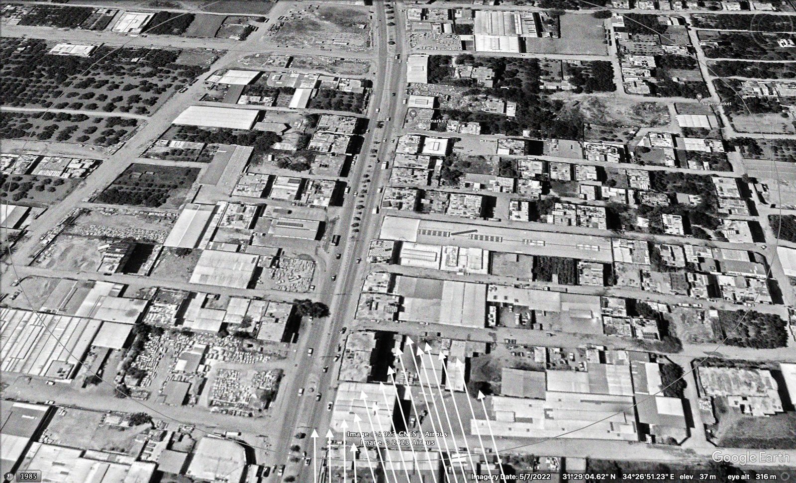
Based on the extent of the damage and the direction and pattern of the munitions' impact, the shells were likely fired from the northeast of Gaza City, from the direction of Israeli settlements. The team could not find sufficiently recent satellite imagery to precisely identify Israeli military positions there, due to this type of imagery being encrypted or withheld at the time this investigation was prepared.
It should be noted that this analysis does not constitute a formal technical opinion by weapons experts, nor does it represent a definitive claim by the investigating team — it is a reading of the data available at this time. And while there is a possibility that the recovered munition remnants belong to a military force operating within the permitted range for firing this type of shell, this cannot be confirmed with certainty; the munition remnants remain additional evidence that warrants consideration of other possible explanations for their presence at the incident site.
32 sources, and an official narrative that collapses under analysis
This investigation is the product of analysis conducted by the NAWA Media open-source investigations team of documented visual content on the attacks against a displaced persons' convoy on Salah al-Din Street on October 13, 2023, aiming to uncover the circumstances of the attack and identify the party responsible for it.