Rainy Seasons in Yemen
Over the past decade, Yemen has endured relentless internal conflicts and political instability, which have directly impacted its infrastructure and other vital sectors. According to UNICEF, despite a decline in active conflict since April 2022, nearly 10 million children remained in need of lifesaving support as of March 2024. Human Rights Watch further highlighted that Yemen faces one of the world’s most severe humanitarian crises, with 21 million Yemenis in need of assistance and suffering from inadequate food, health care, and infrastructure.
The adverse effects of climate change have exacerbated Yemen’s suffering. Extreme weather events have devastated irrigation systems, leading to the loss of agricultural livelihoods and placing additional strain on water and land resources. The United Nations Development Programme (UNDP) has warned that “it is projected that climate change will be responsible for over 121,000 deaths in Yemen by 2060.”
Climate change, rising temperatures, shifting rainfall patterns, and frequent extreme weather events are key drivers of environmental destruction, undermining livelihoods and jeopardizing public health in Yemen.
Agriculture plays a pivotal role in Yemen’s economy and sustenance, with two-thirds of Yemenis relying on farming for their livelihoods, according to the World Bank. However, Yemen’s agriculture is highly vulnerable to climate change, as it predominantly depends on rain-fed farming. Additionally, recurrent floods and torrential rains disrupt not only agriculture and farmland but also critical infrastructure, causing interruptions in basic services and forcing residents to flee their homes.
For decades, Yemen has relied heavily on non-renewable groundwater as a primary water source, leading to the depletion of subterranean reserves. The UNDP reports that Yemen has exhausted the natural water reserves accumulated over 10,000 years within just the past 50 years.
Despite this, rainfall and rainy seasons remain significant for Yemeni farmers, deeply tied to their agricultural practices and cultural traditions. According to the Food and Agriculture Organization (FAO), rainfall affects approximately 50% of cultivated land. Yemen’s climate is generally diverse, shaped by its geographic location and varied topography. However, as noted by Yemen’s National Information Center, despite its access to the Red Sea and the Arabian Sea, these bodies of water have had limited influence on the country’s climate, mainly affecting humidity levels and altering some wind patterns.
Yemen experiences two main rainy seasons: the first in spring, during March and April, the second in summer, spanning July and August. The summer season tends to bring the heaviest rainfall, although precipitation levels vary across regions. According to the National Information Center, the highest annual rainfall occurs in the southwestern highlands, in areas such as Ibb, Taiz, Al-Daleh, and Yarim, where yearly rainfall ranges between 600 and 1,500 mm. In contrast, the western coastal plain, including cities like Al-Hudaydah and Mocha, receives less rain.
In recent years, climate change and its accompanying fluctuations have threatened the traditional patterns of Yemen’s rainy seasons, foreshadowing a more challenging future. Another UNDP report highlights that rainfall trends and projections for Yemen are increasingly uncertain and vary widely on the regional scale. However, the country is likely to experience more intense and severe floods and torrential rains.
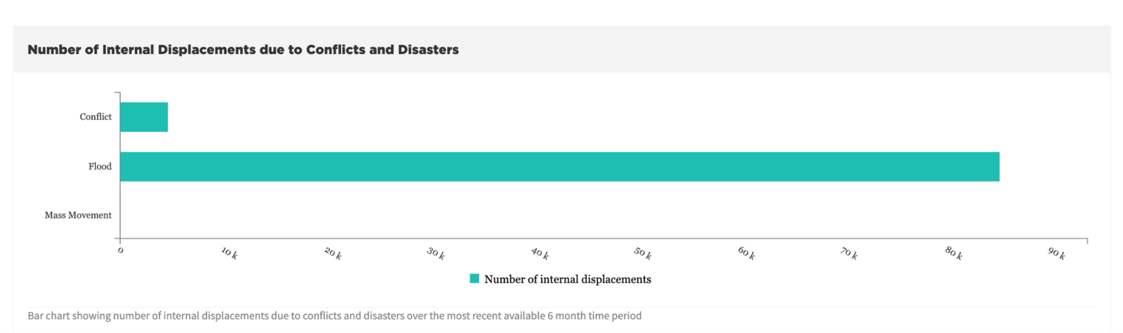
The same report indicates that the highlands and the Red Sea coast are expected to see an increase in summer rainfall in the future. This increase will not only raise the average rainfall but also amplify variability, leading to more extreme weather events such as floods and torrential rains. According to data from the Internal Displacement Monitoring Centre (IDMC), floods displaced approximately 85,100 people internally, compared to 4,600 individuals displaced by ongoing conflict.
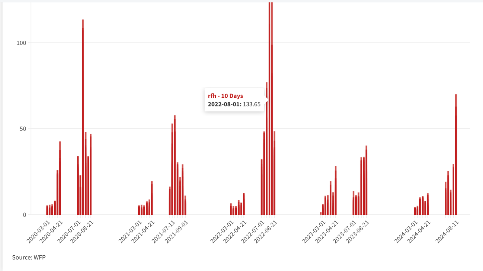
Over the past five years, Hodeidah governorate has seen rising rainfall levels, peaking in August 2022 with 133.65 cubic millimeters recorded — a rainfall event that produced a humanitarian disaster no less severe than in other years.
Al-Hudaydah: In the Path of Torrential Floods
Al-Hudaydah Governorate, located on the Red Sea coast of Yemen, lies approximately 226 kilometers from the capital, Sana’a. Its geographical features make it a natural basin for runoff water, consisting of a flat plain that slopes gently towards the sea. The area’s lowlands also serve as channels for streams that ultimately drain into the sea.
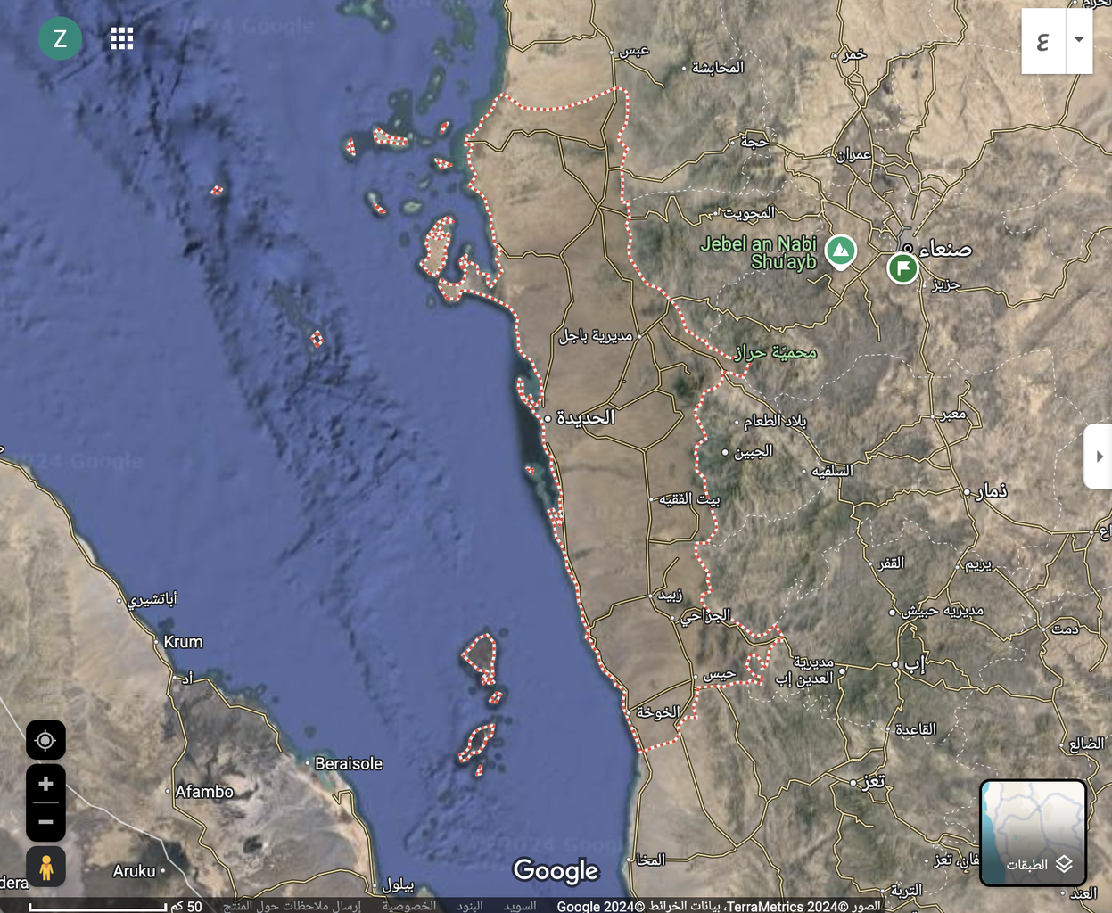
This year, specifically on August 6, 2024, the governorate was hit by catastrophic floods and torrential rains. According to mapping data prepared by the team, the affected and flooded area reached approximately 485 square kilometers, and the floods forced an estimated 150,000 to 170,000 residents to flee their homes.
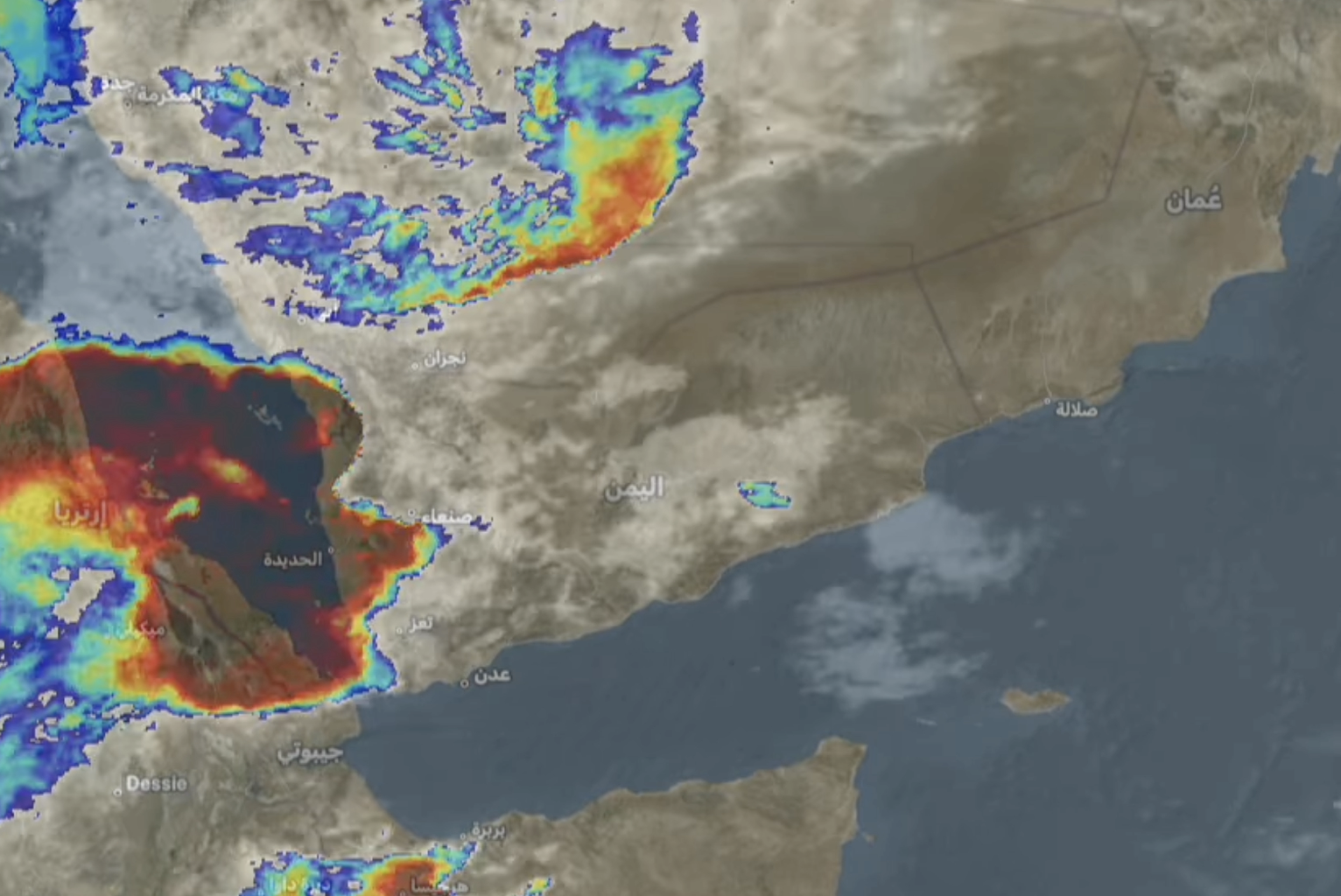
Yemen's National Meteorological Authority recorded roughly 95.9 cubic millimeters of rainfall over Hodeidah governorate between 11:30 a.m. on August 6, 2024 and 11:30 a.m. on August 7, 2024. The floods were not caused by heavy rainfall over the governorate alone, but also by rain that fell across neighboring governorates, whose valleys and plains drained toward Hodeidah over the preceding two days.


Data from Yemen's National Meteorological Authority on rainfall volumes over Hodeidah governorate.
| Station | Rainfall (mm) |
|---|---|
| Ibb | 15.1 |
| Raymah | 16.6 |
| Sana’a | 19.5 |
| Mahweet | 19 |
| Dhamar | 22.4 |
| Hajja | 30.5 |
| Al-Hudaydah | 95.9 |
Rainfall from 11:30 a.m., August 6 to 11:30 a.m., August 7, 2024.
| Station | Rainfall (mm) |
|---|---|
| Ibb-Badan | 49.8 |
| Dhamar | 31.6 |
| Sana’a | 19.3 |
| Hajja | 5.4 |
| Raymah | 3.7 |
| Al-Bayda | 2.8 |
| Sa’dah | 2.7 |
Rainfall from 10:50 a.m., August 5 to 10:50 a.m., August 6, 2024.
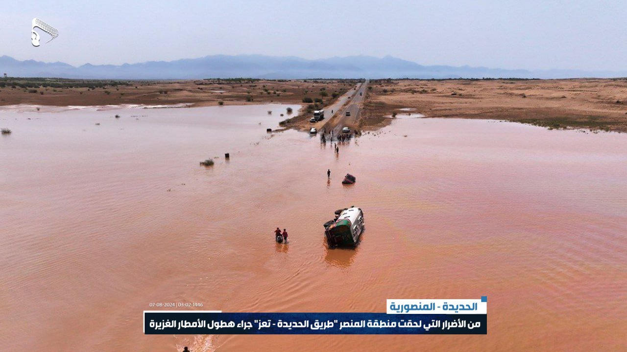
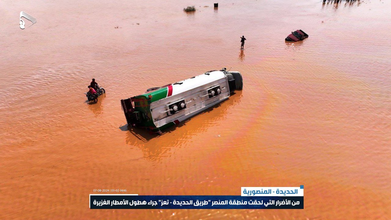
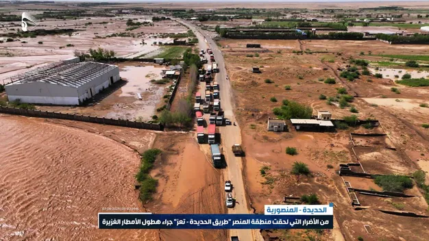
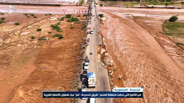
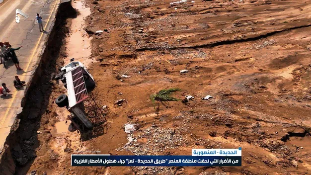
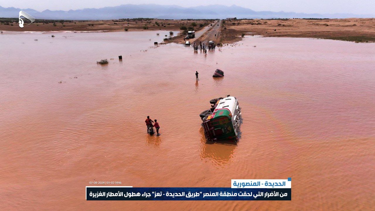
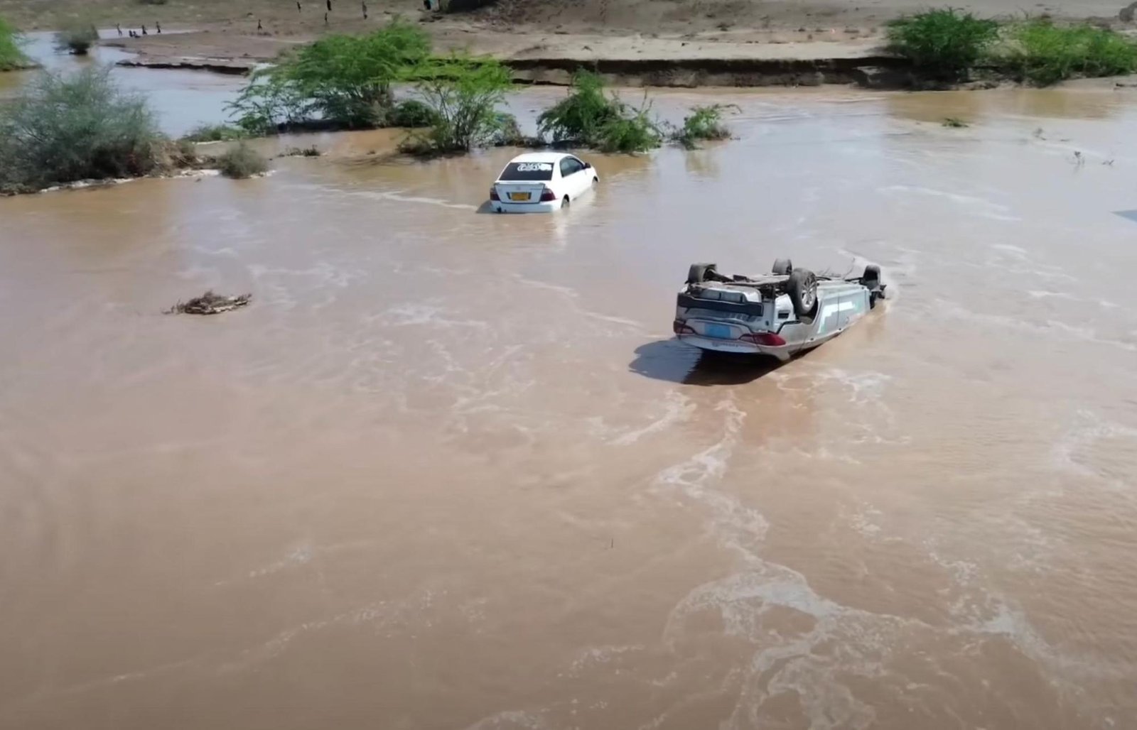
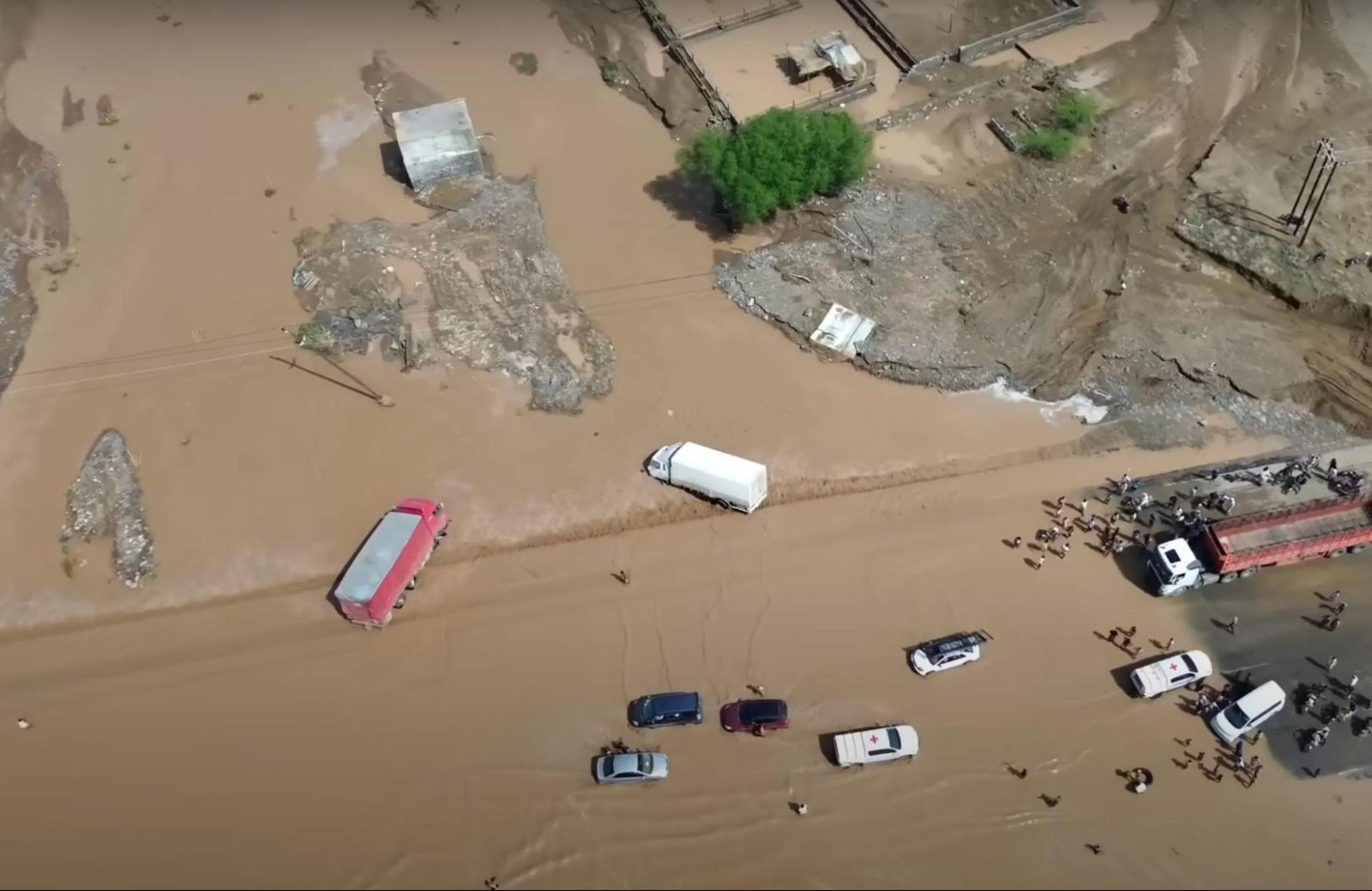
Widely circulated footage documenting the scale of the flooding in Hodeidah governorate, geolocated and verified against satellite imagery.


Social media users and media outlets documented the extensive damage to infrastructure and agricultural lands. A video shared by Ansar Allah's media center shows damage in the Al-Mansar area along the Sana’a–Taiz road in Al-Mansuriyah district. Satellite imagery corroborates the extent of the destruction.
Hodeidah's city center was not the only area affected. Ansar Allah's media center also published photos of the Kassarah area in Zabid district, showing floodwaters cutting through the terrain — footage that matched satellite imagery of the same location.

Al-Qanawis district was also affected by the raging floods, as shown in footage published by Ansar Allah's media center.
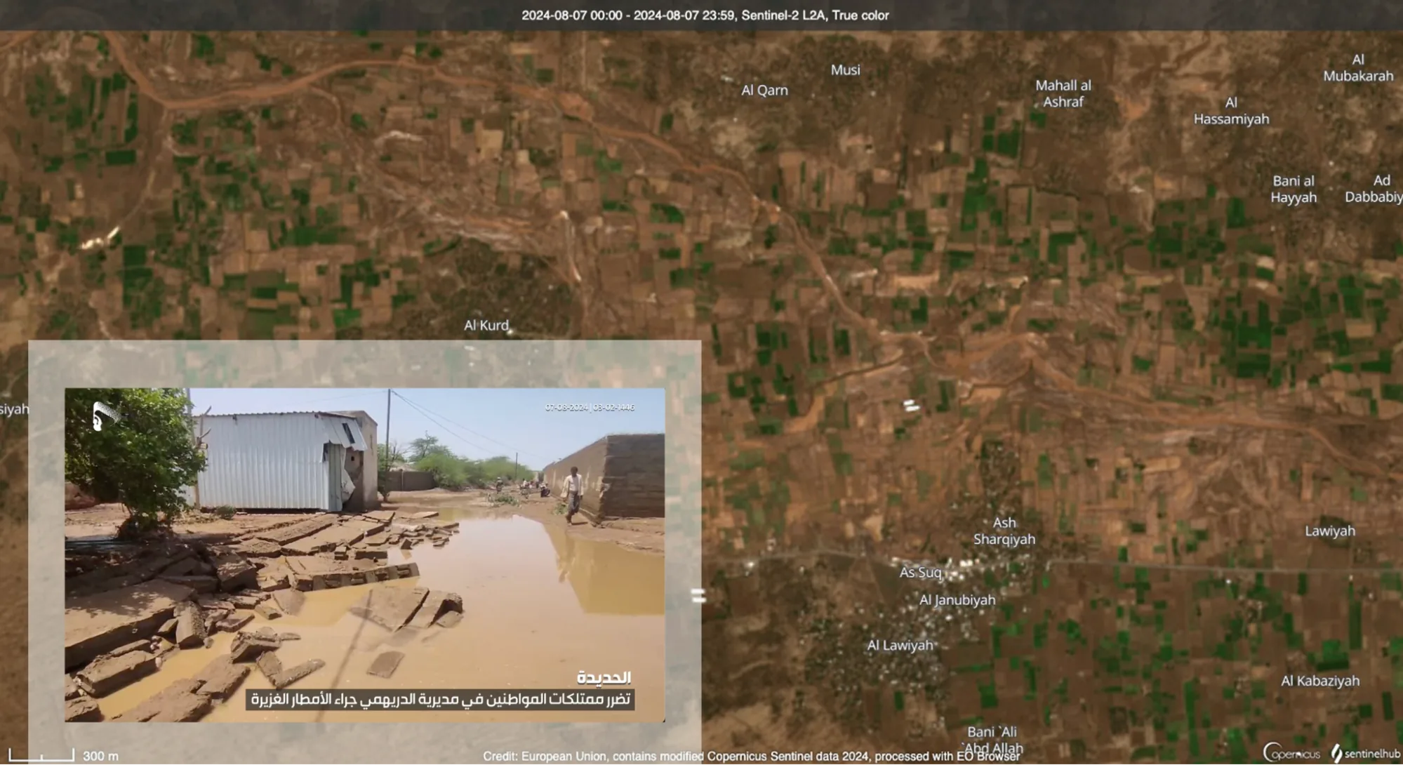
Al-Durayhimi district also sustained damage: bodies of water resulting from the floods could be observed in the village of Al-Lawiya, in the Al-Masa'eed sub-district, through satellite imagery and video footage that was likewise published by the media center.
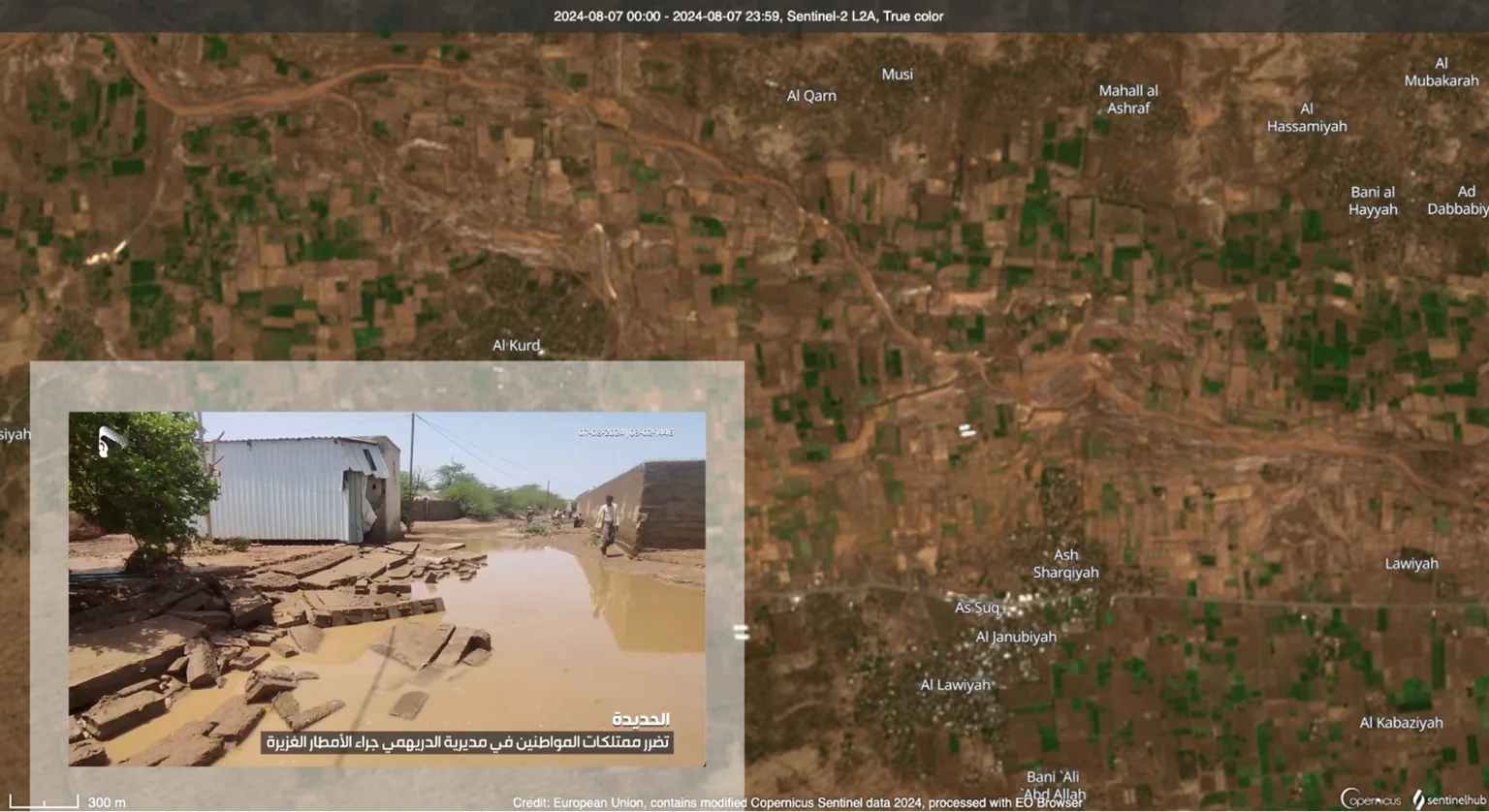
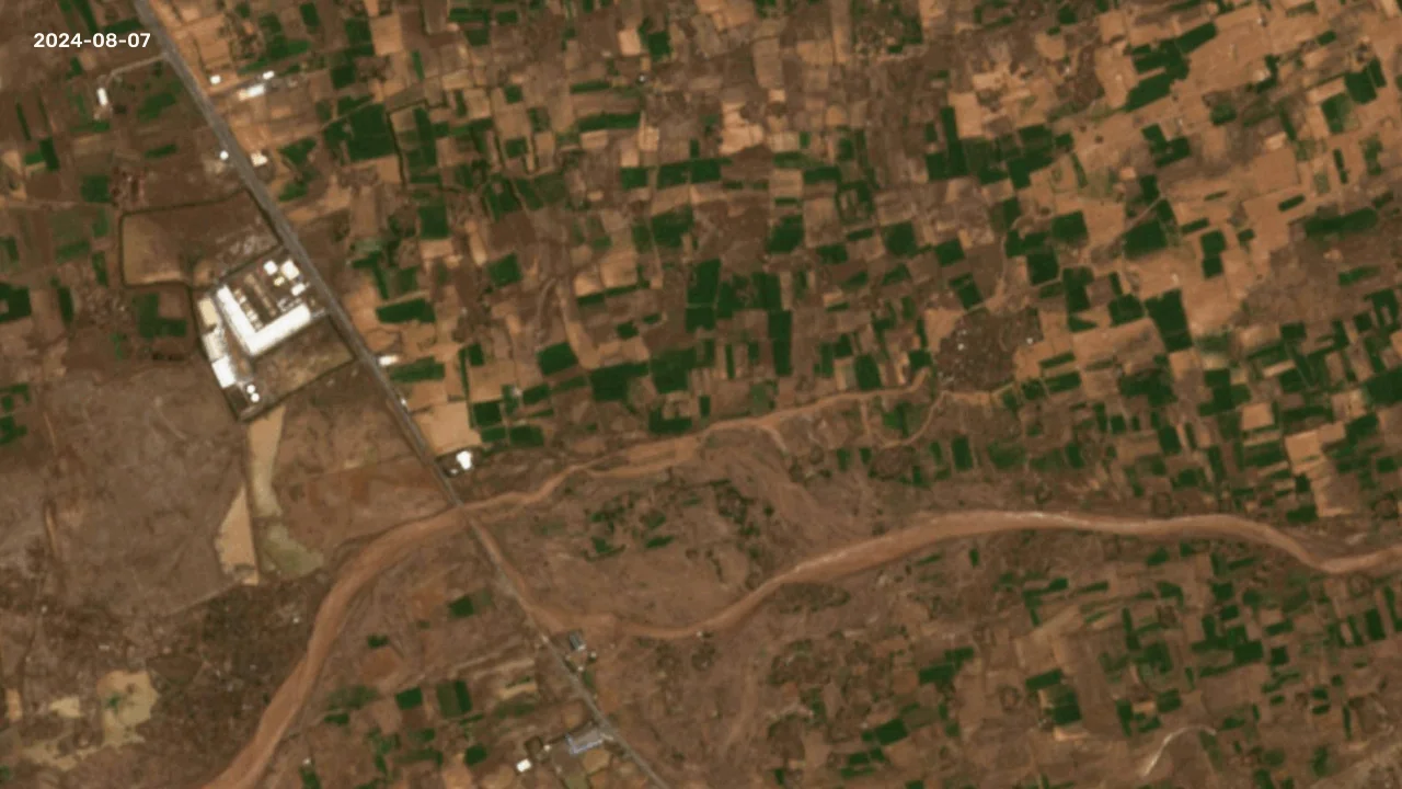
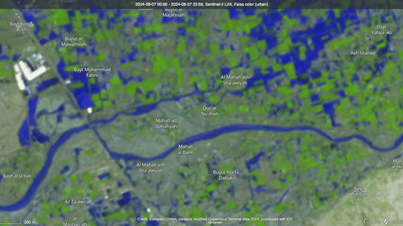
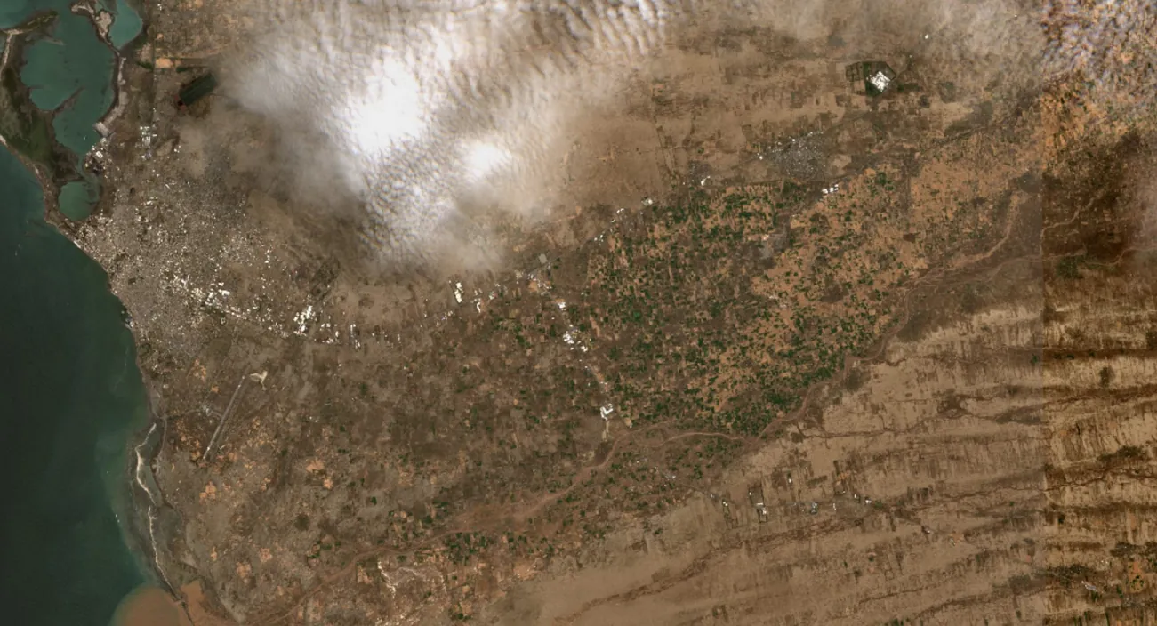
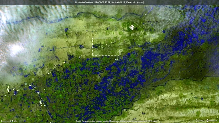
After reviewing satellite imagery from August 7, 2024, the Nawa Media team identified an area known as "Mahal al-Bun" in Al-Durayhimi district, Hodeidah governorate, that had been completely submerged by floodwater. A sequence of satellite images captured the erosion of the area caused by the floods that struck the governorate on the night of August 6, 2024.
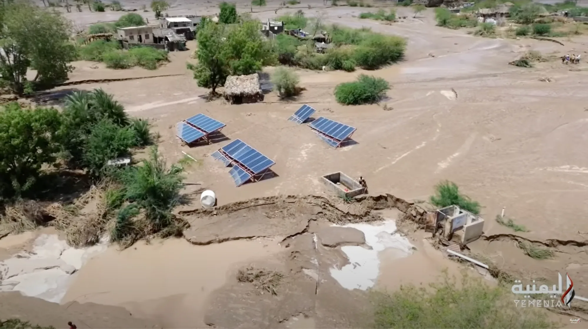
While researching footage of the area, the team found a video report by Al Jazeera, published on August 26, 2024, featuring scenes it described as filmed on August 8. Further research traced the same footage to an earlier upload by Yemenia TV on August 7, showing the disaster that struck on the night of August 6 — consistent with the satellite imagery.
Impact on Farmland
The agricultural sector is a cornerstone of Yemen’s economic development. According to World Bank data, cultivated land accounted for 44.4% of Yemen’s total land area in 2021, and the sector contributed an average of 28.7% to GDP in 2018.
However, agriculture is among the sectors most affected by climate change and extreme weather events, which often destroy crops and agricultural infrastructure. The UNDP warns that “continued cycles of drought and floods can exacerbate runoff and erode the soil, hampering yields beyond the immediate term.”
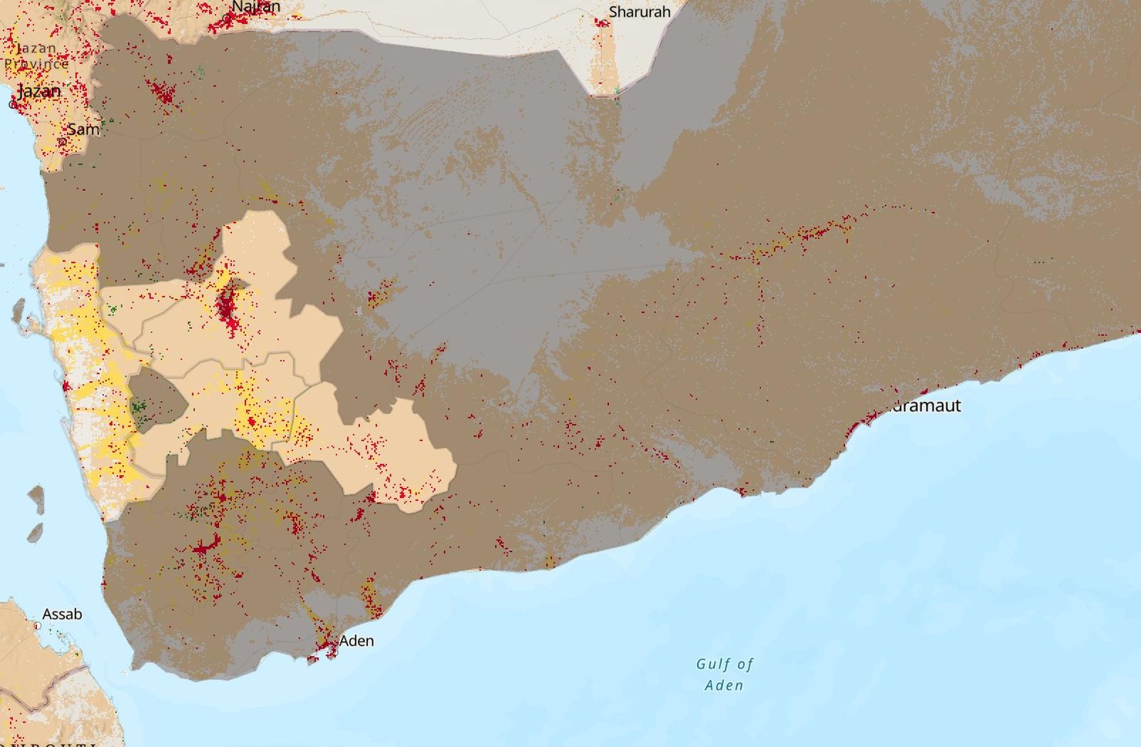
The Yemen Red Crescent Society reported that between April and August 2024, floods affected 19 governorates, impacting 63,195 families. The most affected areas included Hajjah, Al-Hudaydah, Ma’rib, Taiz, Sa’dah, Al-Jawf, and Dhamar — most of these governorates are home to vast and fertile agricultural lands. These agricultural areas can be identified on the map data prepared by the investigative team.
Returning to the visual material circulating from the night of the disaster in Hodeidah, extensive farmland appeared affected — either washed away by the floods or submerged entirely. Media outlets and social media users also shared footage of trees that had been uprooted. The scale of the impact becomes clearer when considering that Hodeidah is one of Yemen's most important governorates for food production, effectively serving as the country's breadbasket.
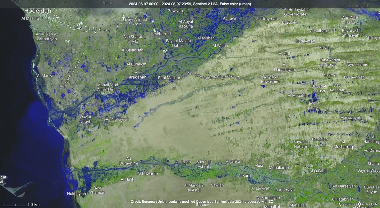
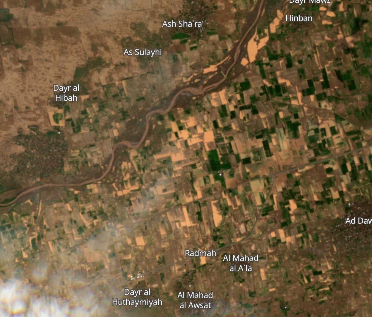
Comparing agricultural areas using satellite imagery captured on August 7, 2024 makes the scale of the impact clear. The team compared imagery of part of Hodeidah governorate from a land-cover data map — with farmland marked in yellow — against a separate satellite image identifying areas submerged by floodwater in dark blue. The comparison indicates that the majority of agricultural areas had been submerged.


Waterborne Disease
Floods and torrential rains in Yemen not only devastate infrastructure but also exacerbate health crises and lead to the emergence of public health disasters. Among the most severe health consequences associated with floods are respiratory and gastrointestinal infections, waterborne diseases, and insect-borne illnesses caused by stagnant and contaminated water. Additionally, mortality rates increase due to inadequate healthcare infrastructure, which prevents civilians from accessing medical facilities. Floods also destroy supply systems, irrigation networks, and clean water sources, contaminating them with sewage and other pollutants.
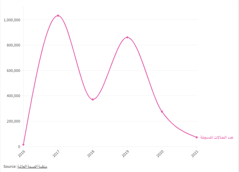
This dire situation further compounds Yemen’s already alarming health crisis. For instance, in 2017 alone, suspected cholera cases surpassed 1.227 million, according to World Health Organization (WHO) data. By 2019, approximately 1,200 cases were being recorded daily. Between 2016 and 2022, over 2.6 million cholera cases were reported, resulting in 4,000 deaths.
The World Health Organization recently reported an outbreak of acute watery diarrhea and suspected cholera cases, noting that around 30,000 cases were recorded between January 1 and April 29, 2024 across all 22 of Yemen's governorates, with most concentrated in the northern regions.
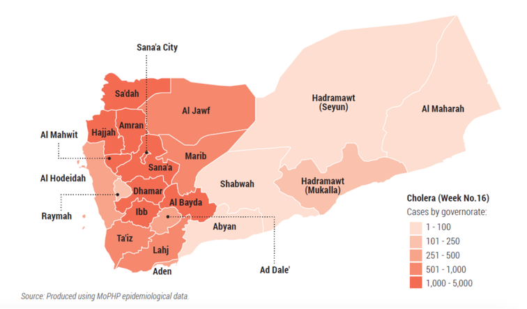
World Health Organization data on the spread of waterborne disease in Yemen.
With the rising number of suspected cases, WHO predicted in May 2024 that total cholera cases could range between 133,000 and 255,000 by September 2024. While it is unclear whether these estimates accounted for natural disasters like floods and torrential rains — particularly as they struck regions recently affected by cholera outbreaks in July and August — other factors were considered, such as funding shortages, limited healthcare facilities, and disrupted supplies due to ongoing military operations in the Red Sea, which place rapid response teams at risk of being overwhelmed by the growing demand for medical care.
Beyond the health impact, floods claim lives directly through drowning and sweeping people away. Following the heavy rains and floods on the night of August 6, 2024, WHO reported 30 fatalities and 5 missing persons.
WHO also highlighted that floodwaters submerged and caused severe damage to essential healthcare facilities, including:
- Bajil hospital and health centres in Al-Marawa’ah, Al-Zaydiyah and Al-Zuhra districts were inundated.
- The Tuberculosis Centre suffered extensive damage, with all equipment and medications destroyed.
Yemen's climate challenges are becoming starkly clear as environmental disasters and extreme weather events intensify — including flood damage in Al-Marawiah district, Hodeidah governorate, also identified through satellite imagery. Yet the country's ongoing political conflict appears to be obstructing the adaptation and risk-management plans essential to confronting these challenges. Yemen's climate outlook is alarming, underscoring the urgent need for effective action to mitigate these harms and to develop a sustainable strategy for adapting to climate change.