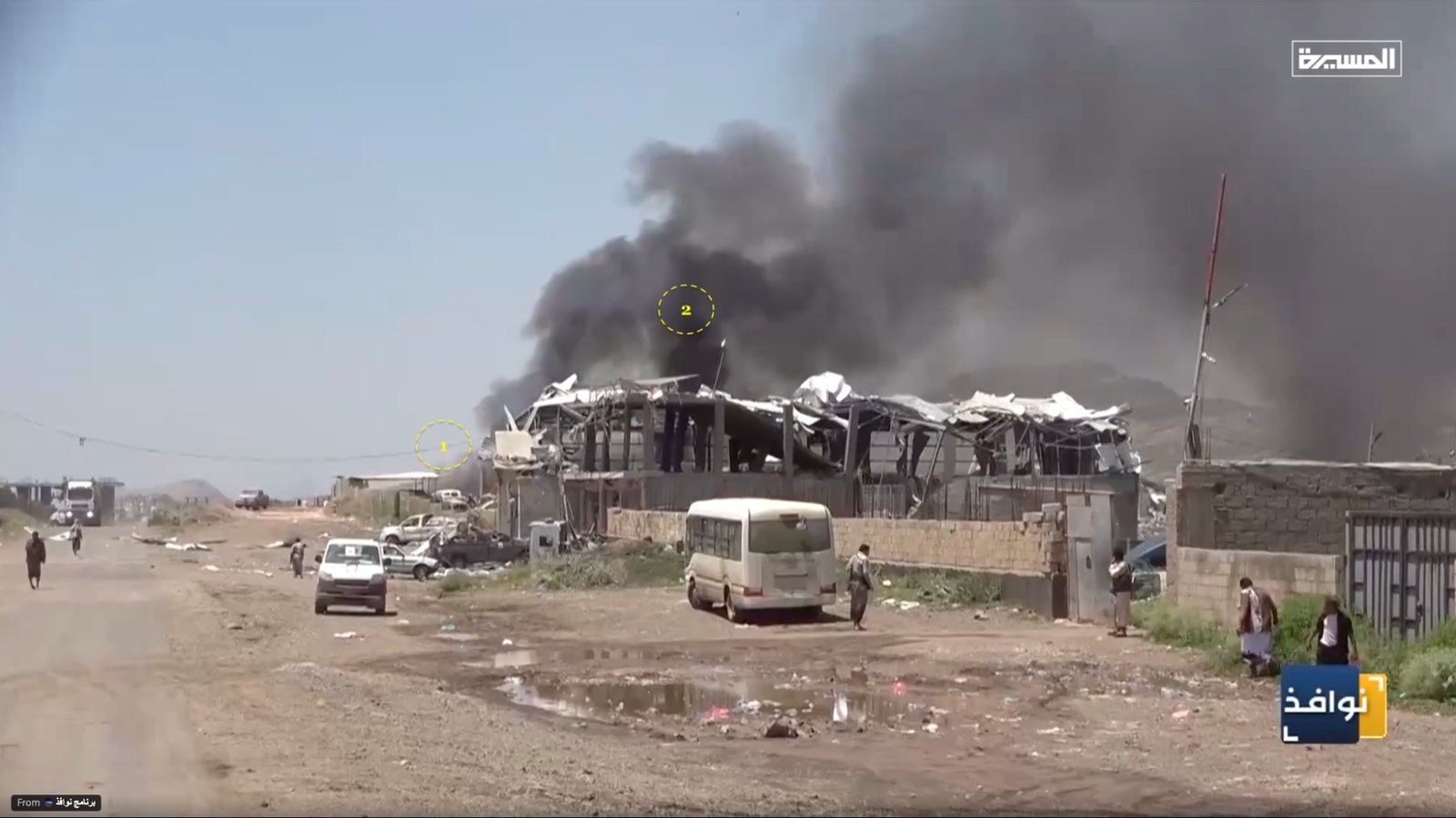
The Mafraq Mawiyah area in al-Hawban, east of Taiz city, was hit by airstrikes around midday on Sunday 27 September 2026. According to a statement from the health ministry of the Sanaa government run by Ansar Allah (the Houthis), seven people were killed and 40 others injured, including five children, in strikes that hit shops in the “Economic Corporation Market”. The group's military spokesman attributed the attack to a formation of Saudi fighter jets. By contrast, Yemen's internationally recognised government announced that its aircraft had targeted a Houthi camp and vehicles in the same Mafraq, and government military sources told Reuters that the group had recently set up a camp near the market.
The incident came amid a military escalation that began in early July 2026 and was described as the widest since the April 2022 truce, according to Anadolu Agency. Fighting accelerated in September, when the Houthis took the city of Mokha and Mayun island overlooking Bab al-Mandab, while government forces stepped up their airstrikes and drone strikes on the Taiz, Lahij and al-Dhale fronts.
The day before the incident, the Yemeni news agency Saba quoted a government military source as saying that airstrikes on Saturday 26 September had targeted “ammunition and missile depots in Mafraq Mawiyah and Mafraq al-Dhikra, east of Taiz”. This means the area had been a declared target of government strikes before the Sunday attack.
Mafraq Mawiyah lies in al-Hawban, the Houthi-controlled eastern suburb of Taiz, at the junction of the Taiz–Sanaa road and Mawiyah road, in al-Ta'iziyah district of Taiz governorate. The area includes a wholesale market that Houthi media call the “Taiz Central Market”. Google Maps labels shops there including “Hangar for wholesale vegetables”, “Taiz wholesale vegetables and fruit” and “National Dairy and Food Company warehouses”. OpenStreetMap also records a point named “Yemen Economic Corporation Market” and two qat markets in the surroundings.
When did the attack happen?
The Houthi military spokesman, Yahya Saree, posted his account of the timing on X (formerly Twitter). He said the warplanes left the air base at Khamis Mushait in southern Saudi Arabia at 11:00 a.m. Yemen local time, carried out two strikes on the Taiz market at Mafraq Mawiyah at 11:29 a.m., and left Taiz airspace at 11:37 a.m.
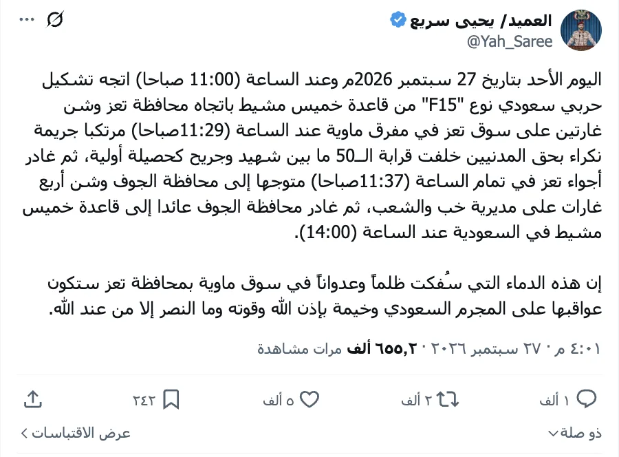
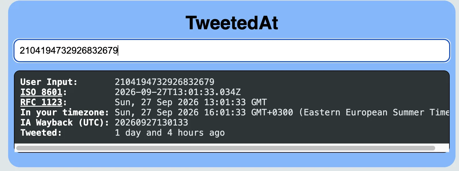
Screenshot of a post by Yahya Saree, the Houthi military spokesman. The post is in Arabic and gives the times above: departure from Khamis Mushait at 11:00, two strikes on the Taiz market at 11:29, and departure from Taiz airspace at 11:37.
A deeper search for the first accounts to report the incident on X turned up the account “Abdulsalam al-Mikhlafi”, which reported more than six strikes at Mafraq Mawiyah and Camp 22, north-east of Taiz city, at 11:39 a.m.
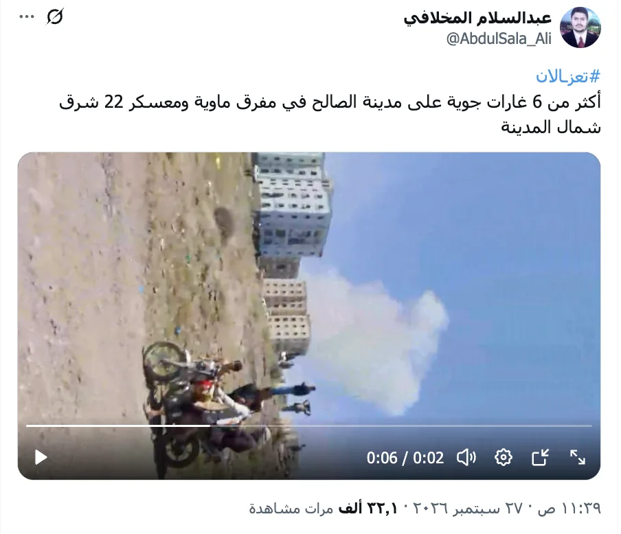
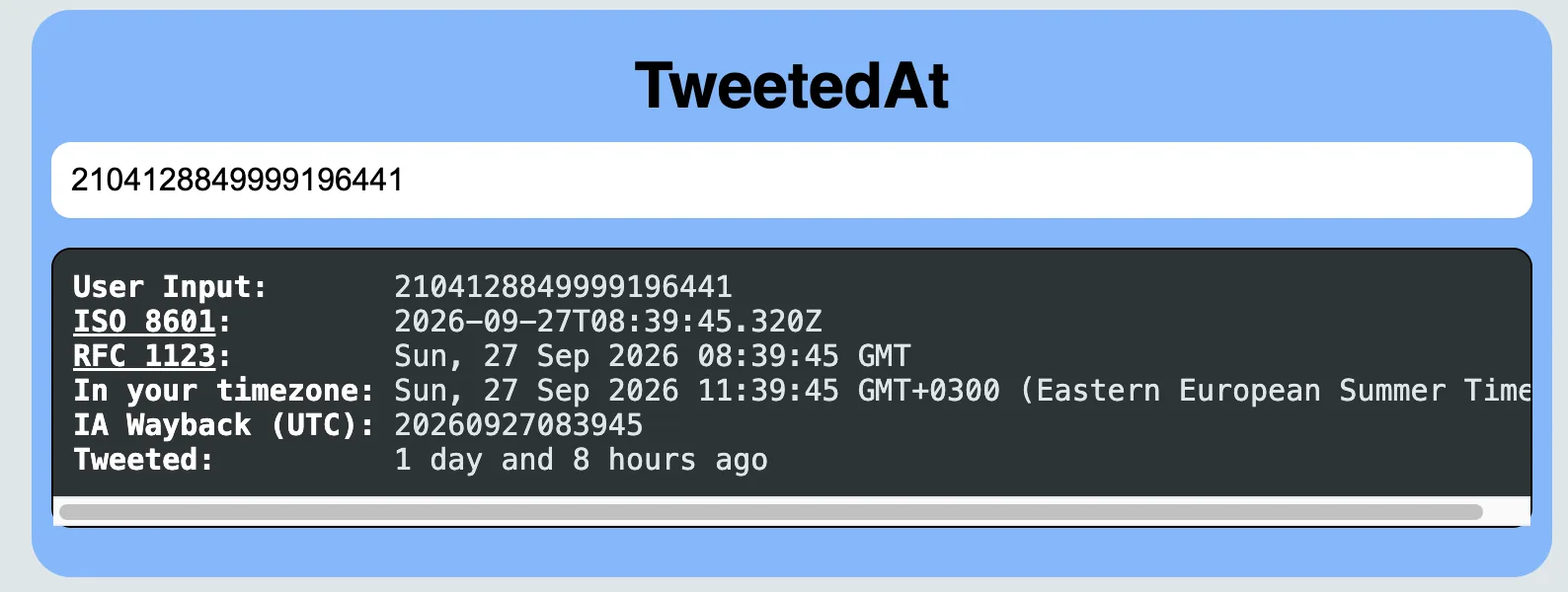
Screenshot of a post by Abdulsalam al-Mikhlafi. 11:39:45 a.m. The post is in Arabic and reports more than six strikes at Mafraq Mawiyah and Camp 22.
Two minutes later, at 11:41 a.m., Abdulsalam al-Mikhlafi posted again, claiming that two weapons trucks had been hit in front of the Greatest Messenger Square at Mafraq Mawiyah in Taiz. At 11:46 a.m., the account of Murad al-Hashimi reported strikes on the Engineers' arms market and the wholesale market at the junction, while at the same time the account Al-Hadath Al-Yemeni reported strikes on Houthi positions at the same junction. The official report came at 12:26 p.m. in a post by the Taiz governorate media office on Telegram, which confirmed an attack on shops in the Economic Corporation Market at Mafraq Mawiyah in al-Ta'iziyah district.

On this basis, the time of the attack on Mafraq Mawiyah can be estimated at between 11:29 a.m., according to the statement by the Houthi military spokesman, and 12:26 p.m., when the Taiz media office published its official statement.
To check this, we ran a shadow analysis of a photo posted on the account of Khaled al-Sahili, in which the shadow of a person standing in front of the gate of the Taiz Central Market during the attack is visible, assuming that person is between 160 and 170 cm tall. We estimated the likely time the photo was taken at between 11:45 a.m. and 12:15 p.m.
We also analysed Abdulsalam al-Mikhlafi's video, which shows a parked motorcycle carrying two people, with residential buildings beside it whose visible features match the buildings of the housing complex called “Saleh Residential City”, labelled “Al-Shaab Complex” on Google Maps. Based on the length and direction of the shadow, and taking the standard height of the motorcycle as between 105 and 115 cm, we estimate the time of filming at between 11:00 and 11:45 a.m. Yemen time.
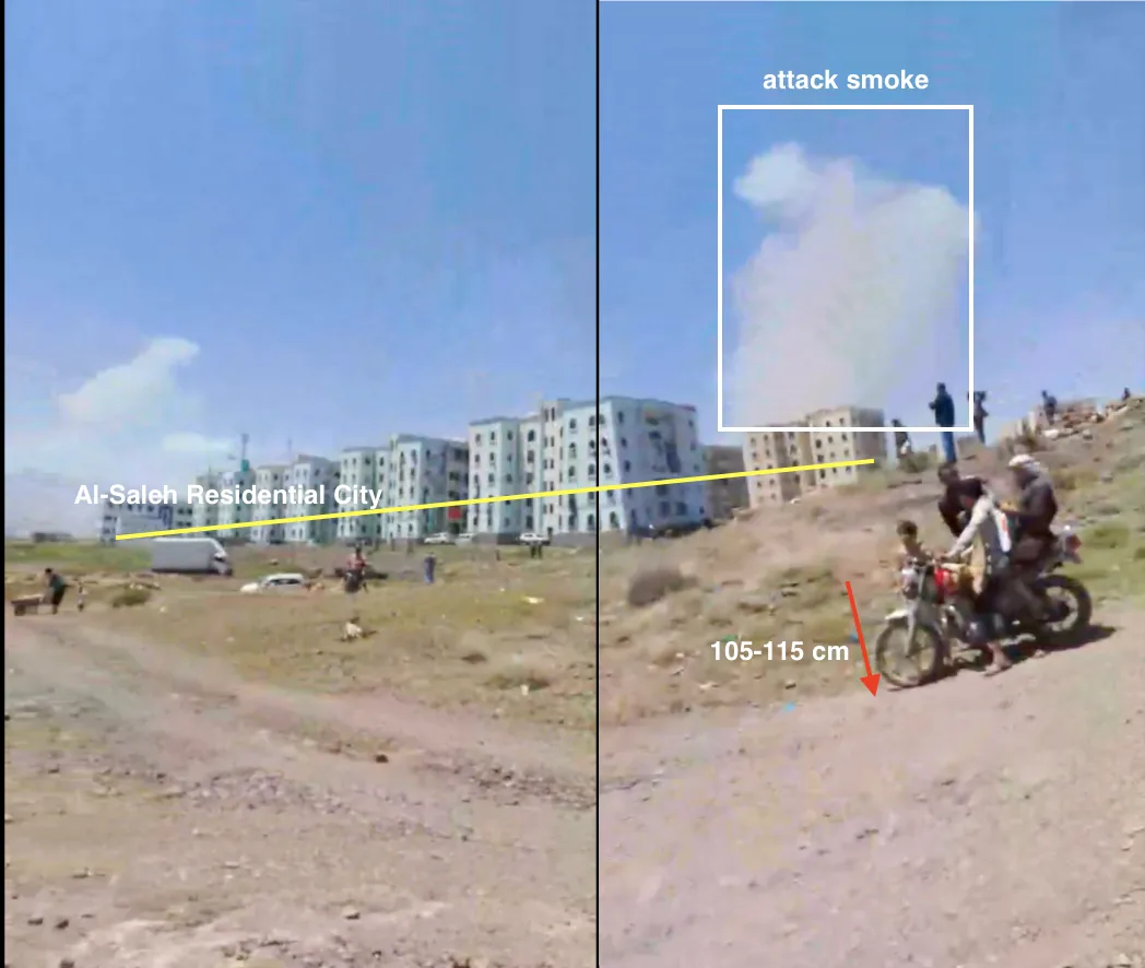
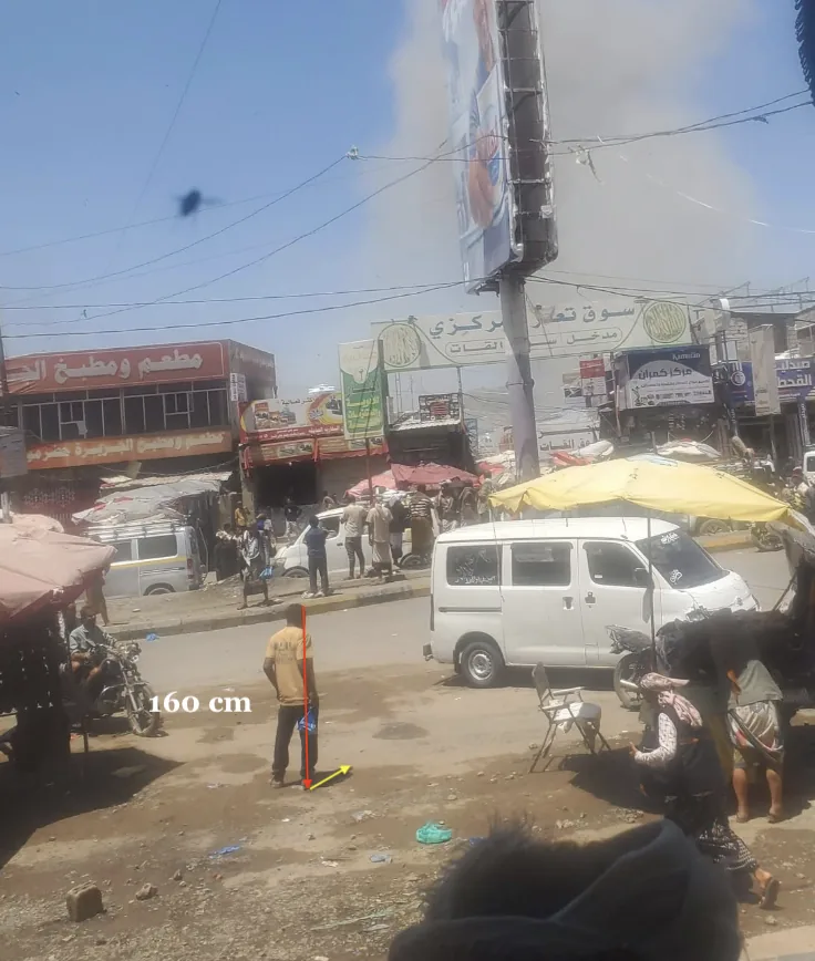
Two images showing shadows: one from Abdulsalam al-Mikhlafi's video, the other posted on Khaled al-Sahili's account.
Where did the strike land?
We first set out to identify the damaged site using the text accompanying the circulating clips, which referred to the “Taiz Central Market”, the “Economic Corporation Market” and the “vegetable market and wholesale market” at Mafraq Mawiyah. Searching Google Maps and OpenStreetMap labels led us to a complex of wholesale vegetable and fruit markets south-east of the junction.
A video from the “Ansar Allah Media Center” shows a commercial hangar whose facade reads “Al-Mutawakkil Food Stores”. It houses a retail grocery, which may be the same one as the Thirty grocery named on Google Maps, and, attached to it, a two-storey building whose ground floor is a wholesale shop. Distinctive landmarks around it matched those in a video from the account @mseer_0: a tall tower whose facade matches that of the New al-Rifai Hospital building, white hangars, two cars and a small kiosk in front of them.
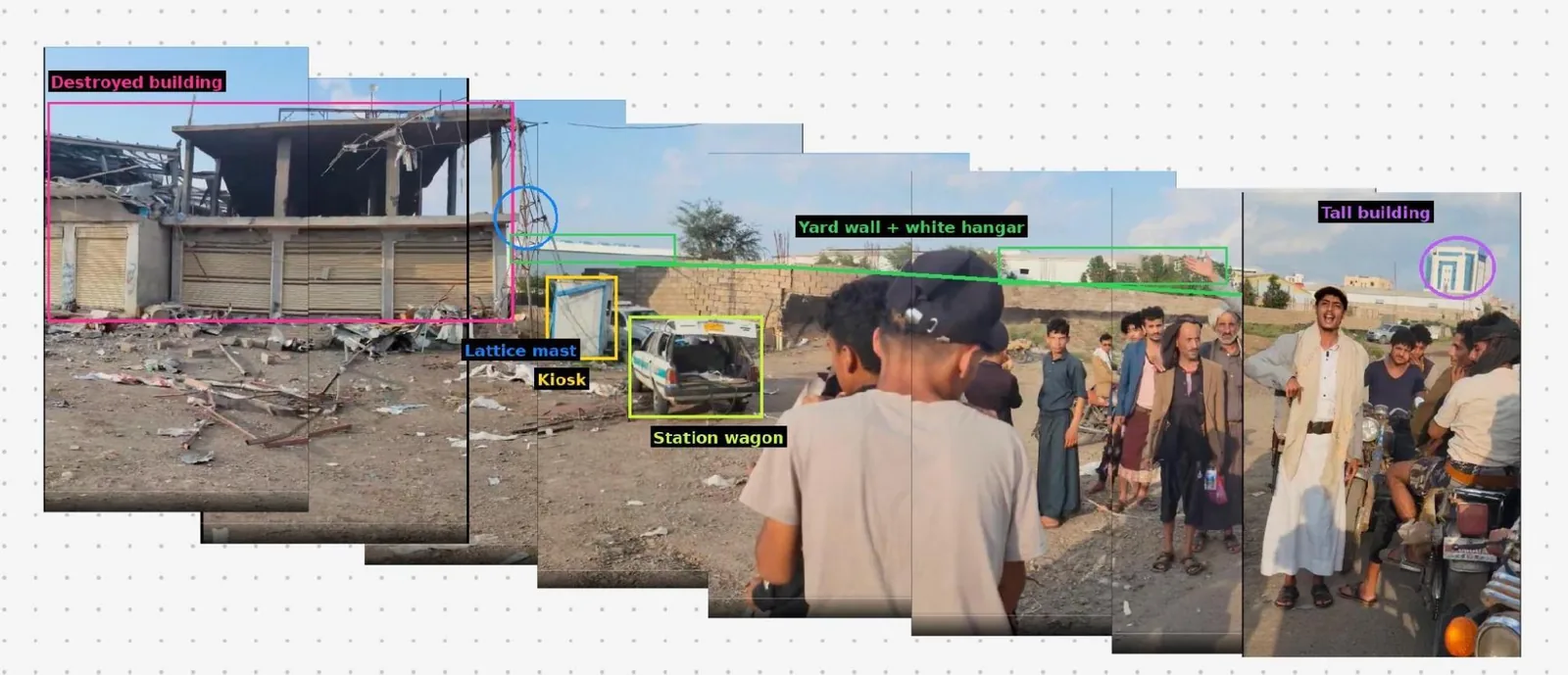
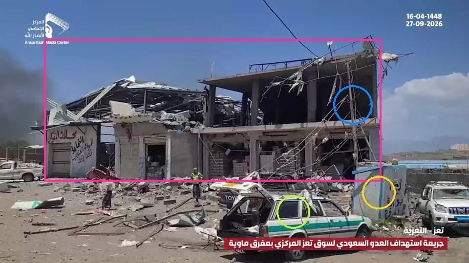
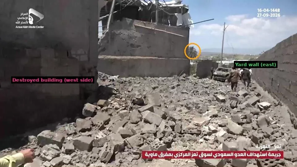
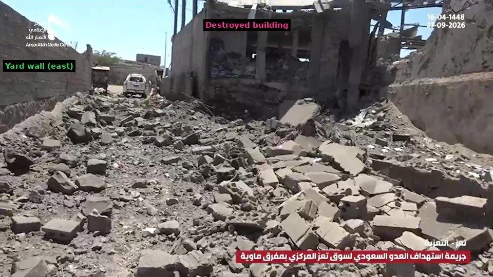
Reviewing the published visual material, using the visible palm tree as a reference point and matching the remaining visual elements in the videos and photos, we were able to place the site at the north-western corner of the junction of a side road called Al-Thalatheen Street with the main Sanaa–Taiz road, on the southern side of the market at Mafraq Mawiyah in al-Ta'iziyah district, Taiz governorate, at coordinates 13.651500, 44.126044.
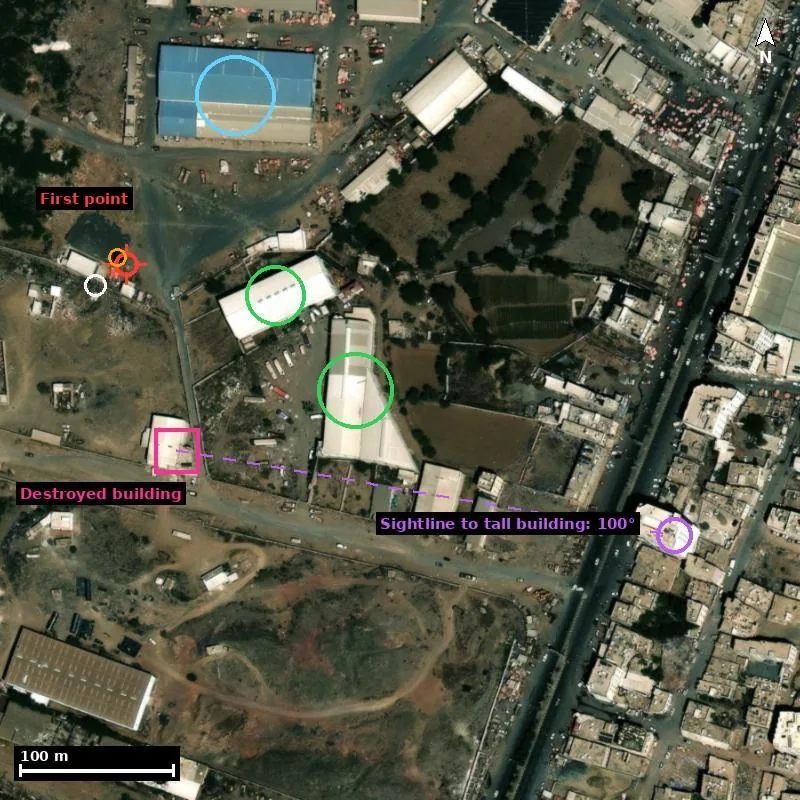
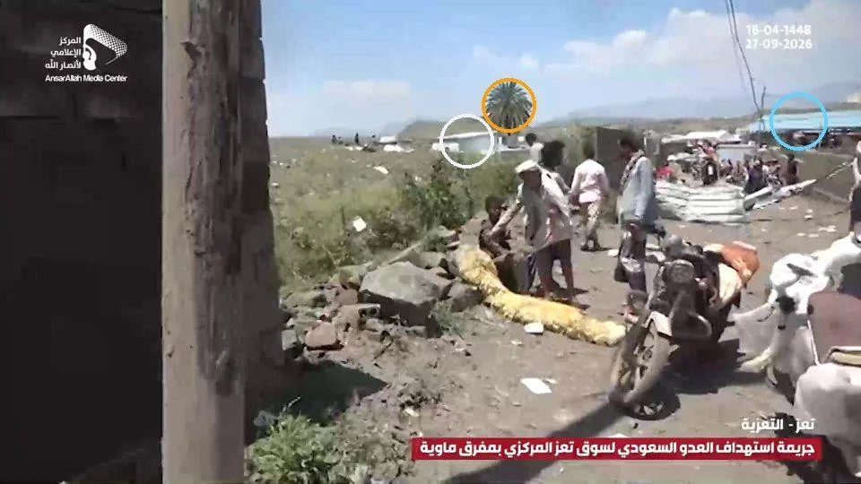
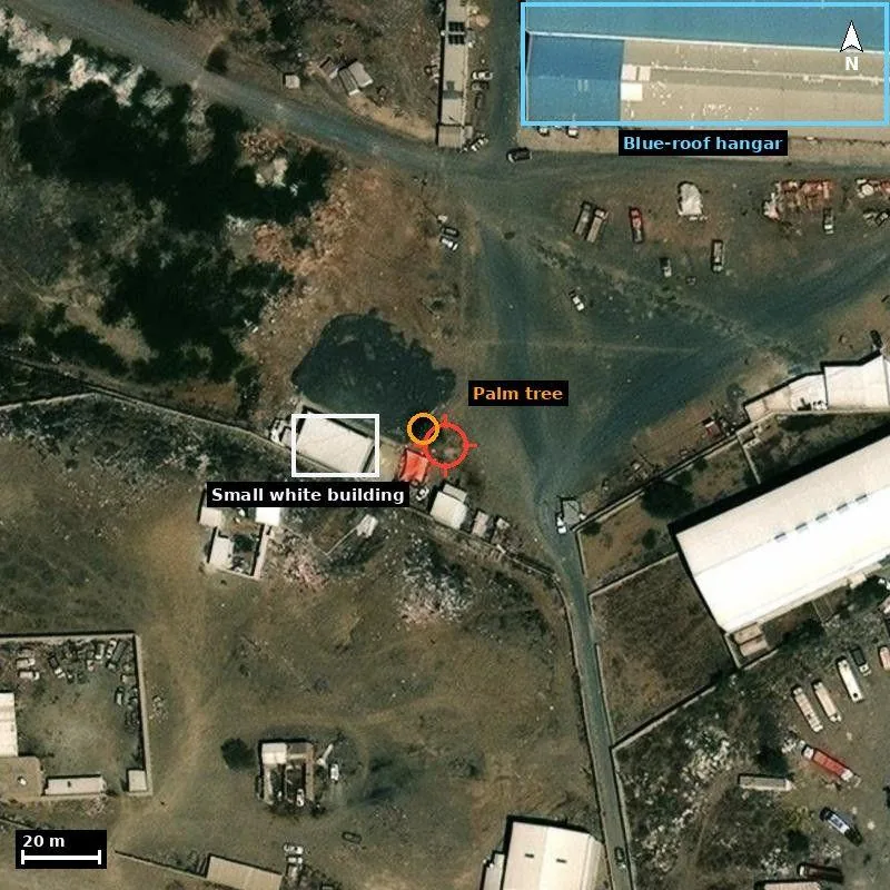
Right: Ansar Allah video, 00:32. The lone palm tree (orange), the small white flat-roofed building (white), and a blue roof on the right. Left: close-up satellite image, 18 February 2024. The palm tree stands 7 metres from the camera position and the small building 29 metres to the west.
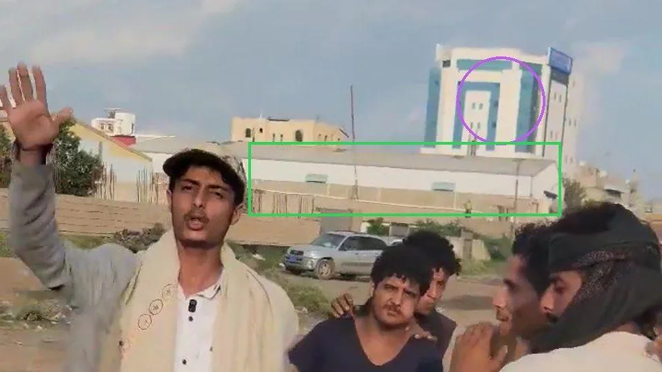
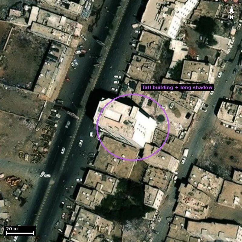
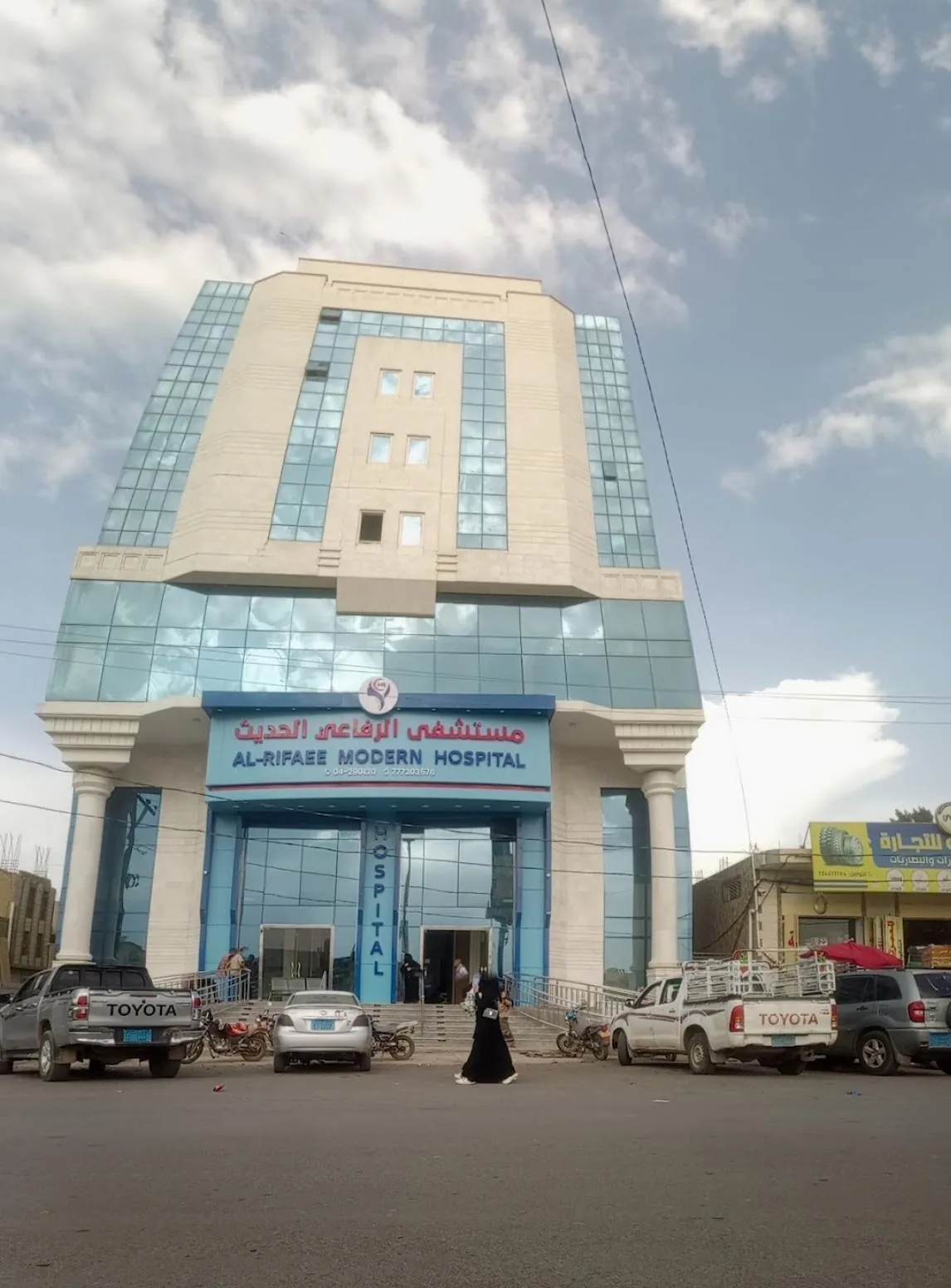
Right: clip from @mseer_0, 00:01. The tall building, al-Rifai Hospital (purple), behind the white hangar and the wall. Left: 18 February 2024. Its long shadow and visible facade confirm its height. The hospital facade is a photo from a Google Maps user.
Of note, the destroyed building is about 200 metres from the nearest wholesale vegetable hangar in the Taiz Central Vegetable Market, about 90 metres from the dairy hangar, and about 400 metres from the qat market.
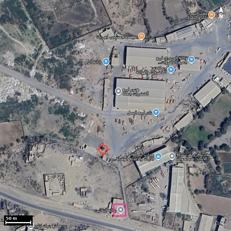
What do recent satellite images show?
Official Houthi media covered the damage to a food hangar called “Al-Mutawakkil Stores”, as well as an adjacent building whose ground floor houses a wholesale food store or shop. They did not cover the other damage in the surrounding area. A person who appears to work at the shop is also seen speaking in a video: “Rush them all to the hospital… the chest rig belongs to Hussein al-Mutawakkil.” A weapon, apparently an AK-47 Kalashnikov rifle, is visible at the cashier's counter. Such weapons are commonly carried by individuals in Yemen.
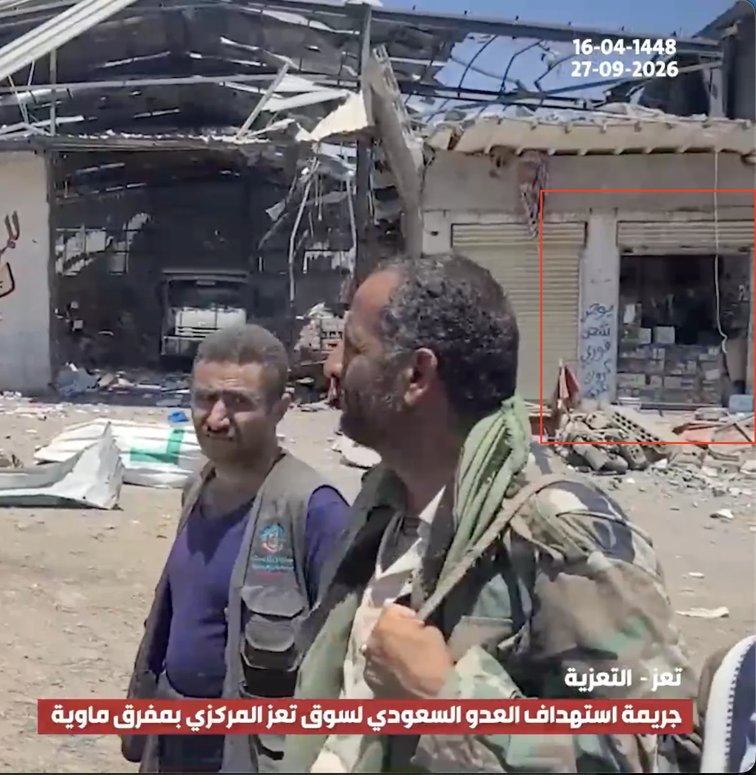
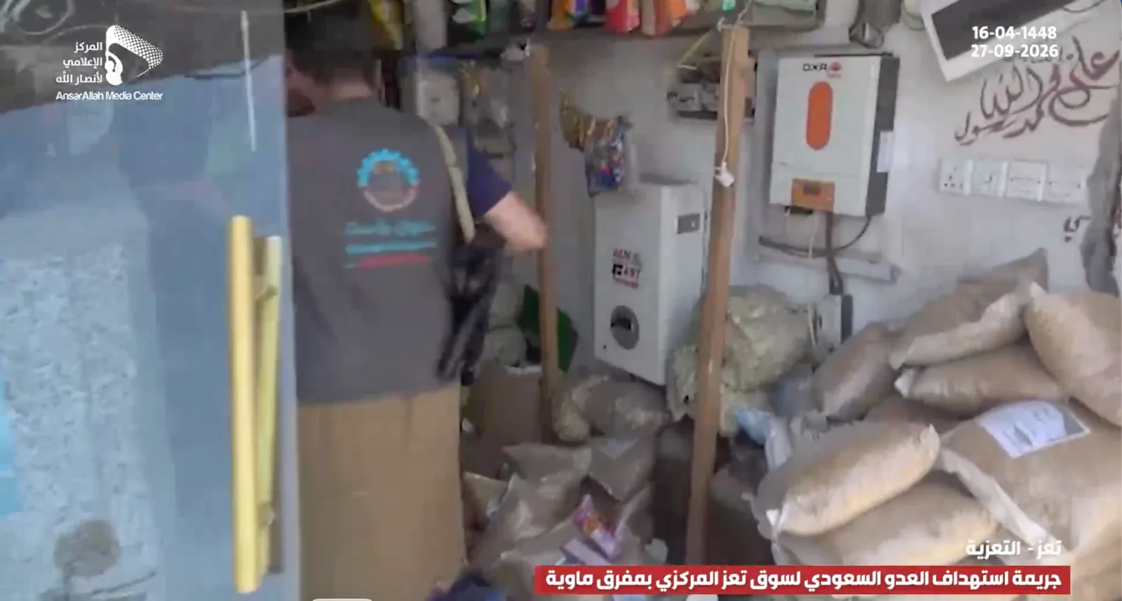
The retail grocery and the wholesale food shop as they appear in the Ansar Allah Media Center video.
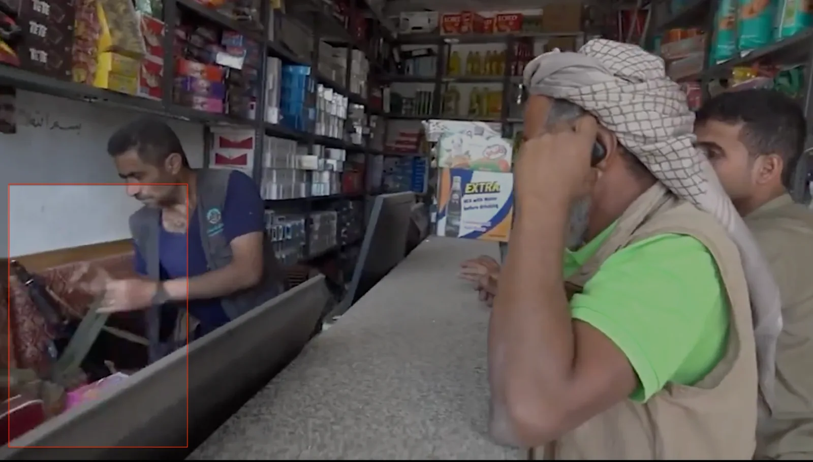
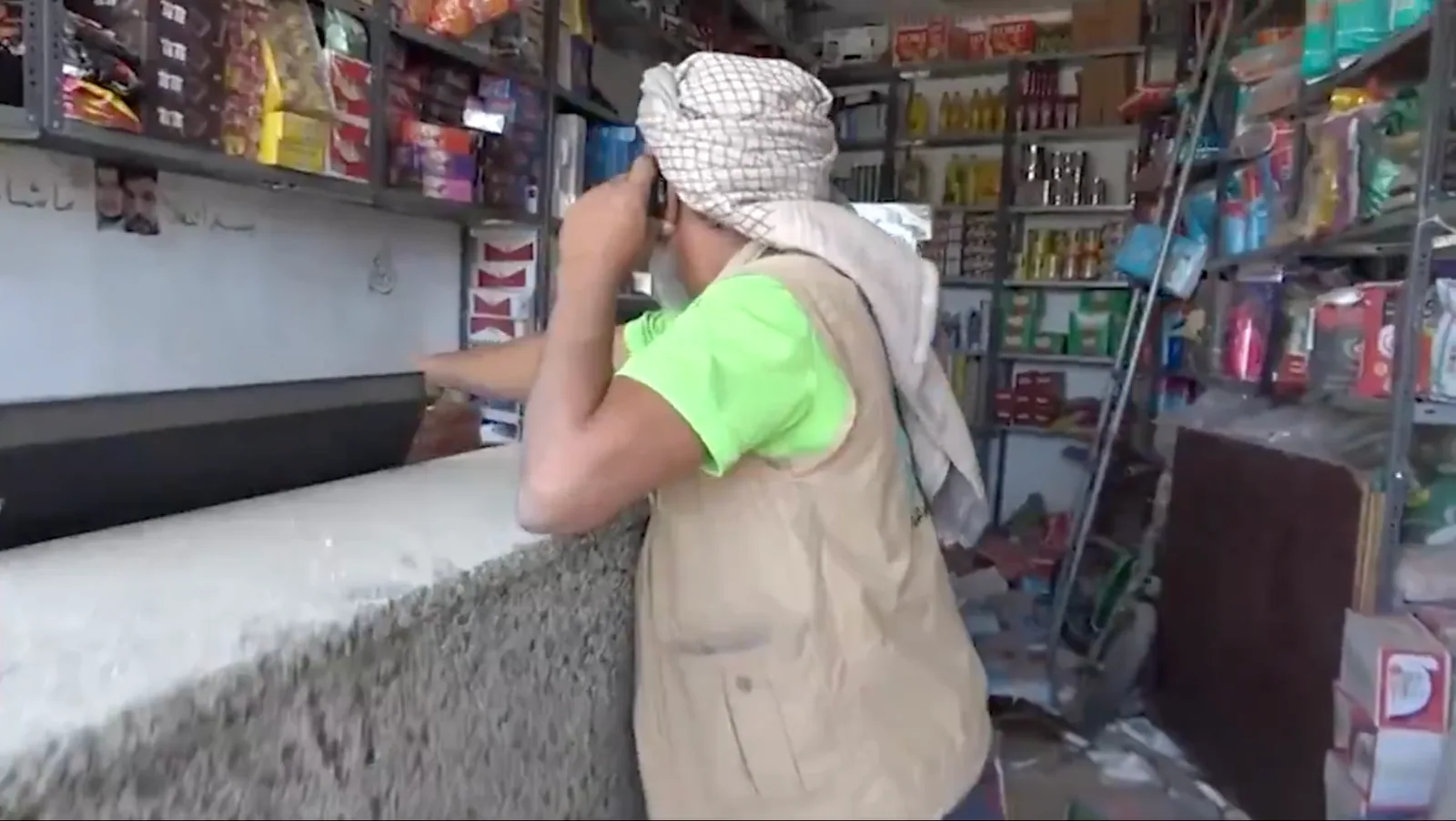
Two frames from Hezam al-Asad's video showing two AK-47 Kalashnikov rifles, as well as another weapon carried by an individual. One of the people present points to a chest rig, a vest used to store and carry weapon magazines and ammunition.
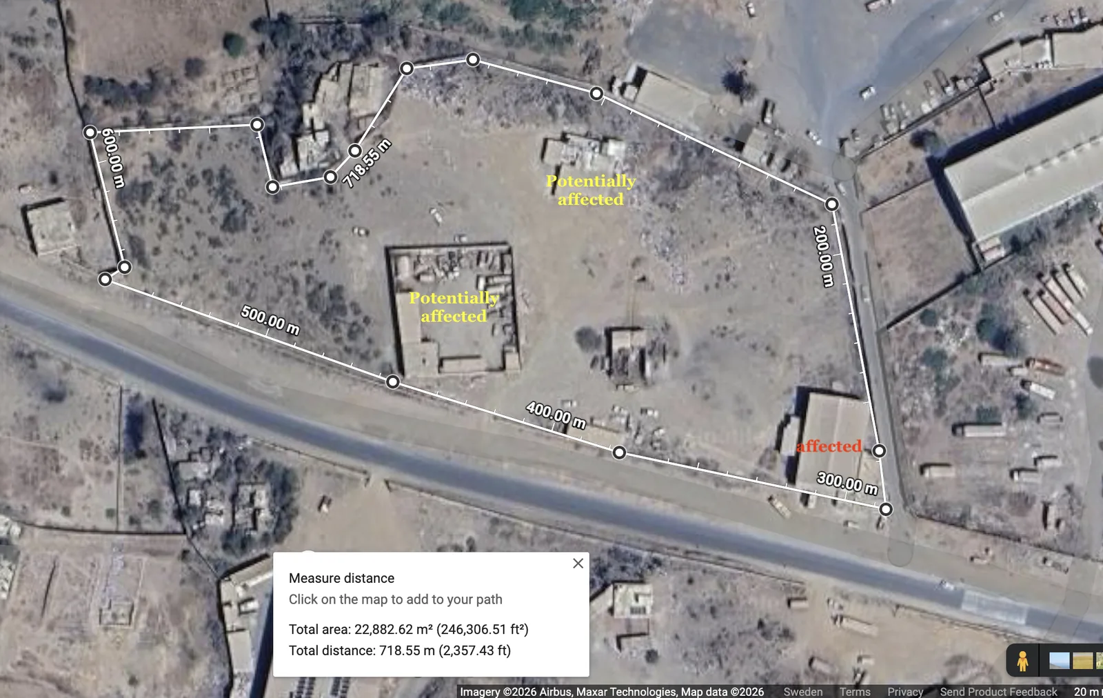
Satellite images captured on 28 September 2026 show damage to, and the disappearance of, at least two sites, probably hangars and warehouses, located around Al-Mutawakkil Stores and enclosed by a single wall. We could not establish how the other two sites were used, because little has been published about them.
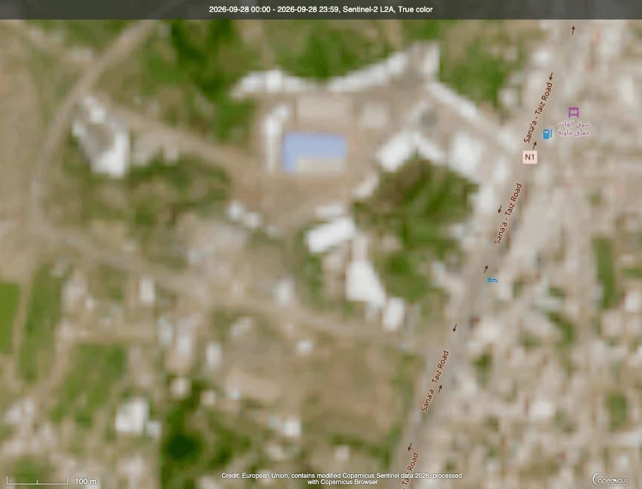
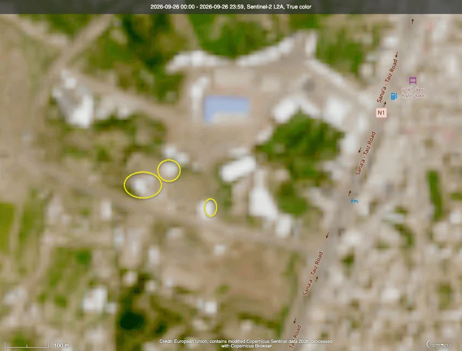
Comparison from Copernicus Browser of the Sentinel-2 satellite images of 26 and 28 September 2026.
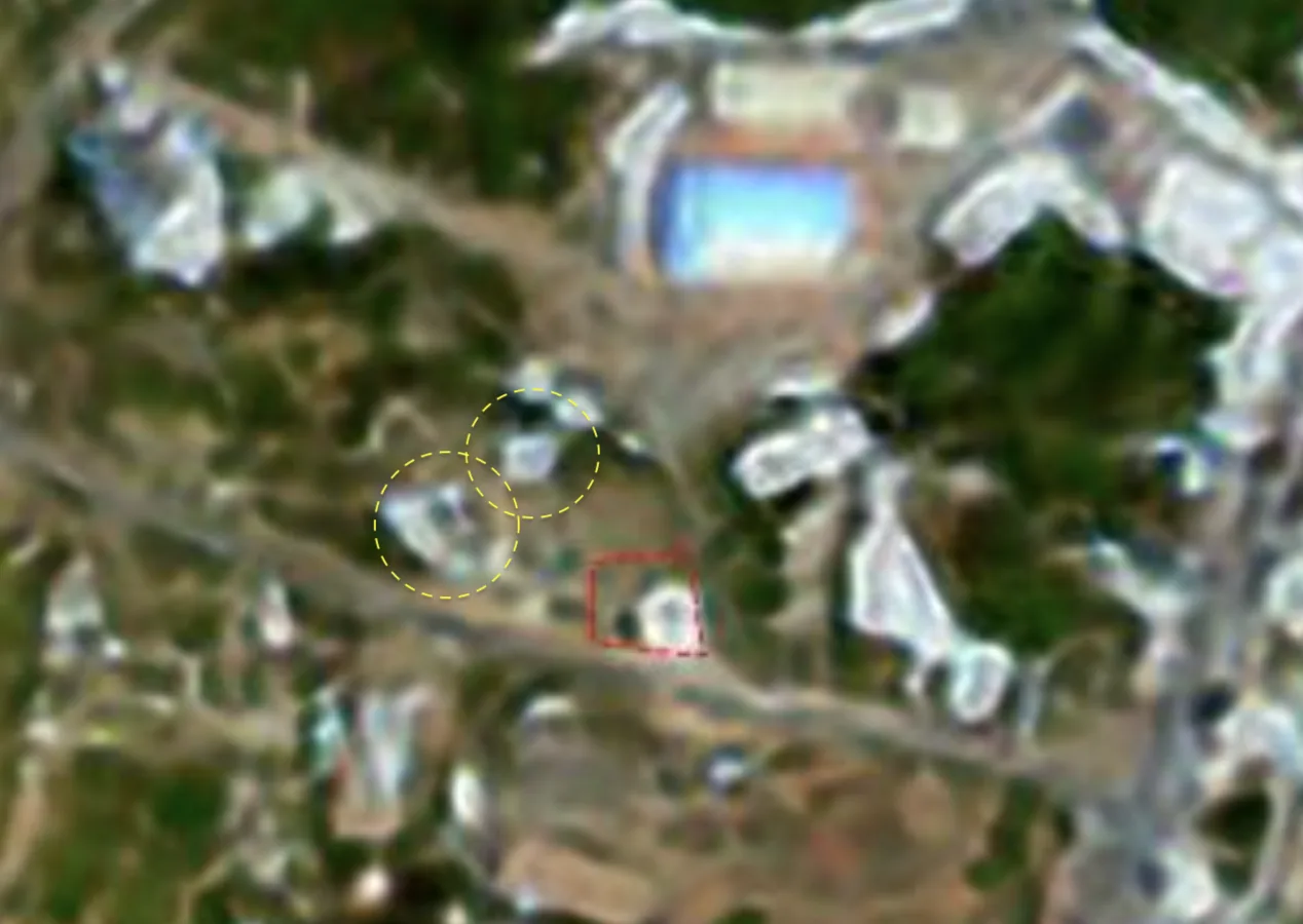
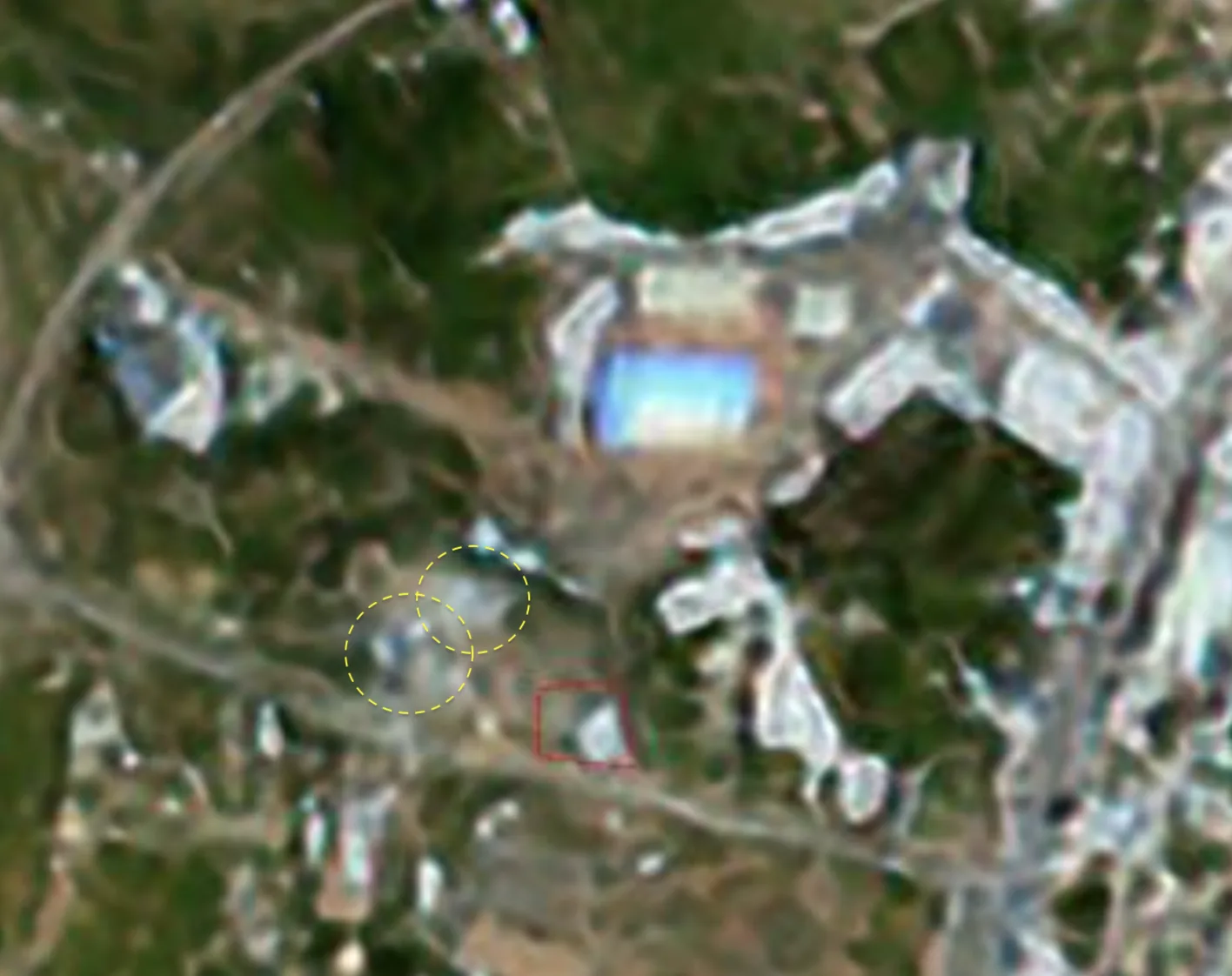
Recent satellite images from OnGeo dated 26 and 28 September 2026.
Of note, some footage showed smoke continuing to rise around the site, probably from the two strikes beside the shops, in addition to circulating claims that the area was hit more than once in the strikes carried out on Taiz at the time.
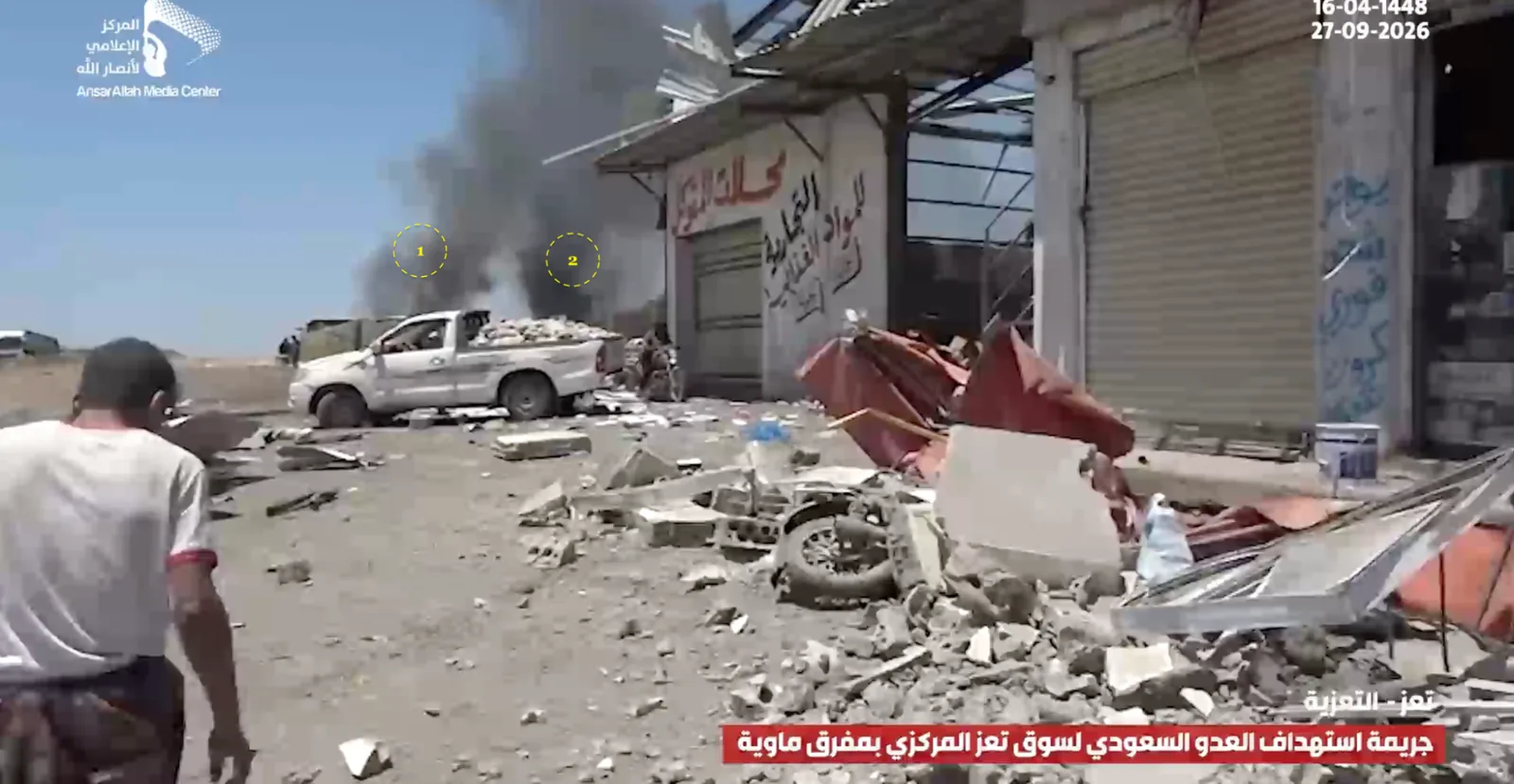
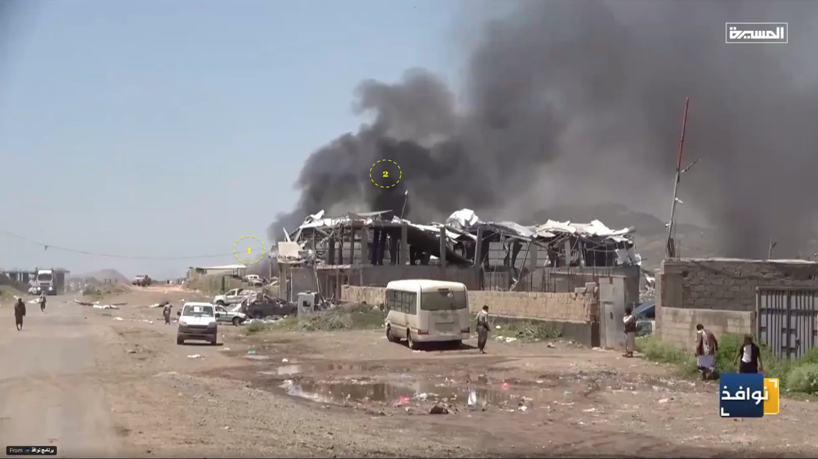
Images of smoke rising near the affected shops.
What do the other clips show?
Users on social media shared various videos claimed to be linked to the incident. One is a clip posted by Fathi bin Lazraq that mentions a warplane attack on Houthi gatherings at the Reception Camp. On close examination we found that it was indeed filmed on the Sanaa–Taiz road near Saleh Residential City. The video shows two airstrikes, one of which probably hit a camp near the area, named on OpenStreetMap “Hawban Camp of the 170th Air Defence Brigade”, near the radio building. The elevation of the area matches the viewing perspective, and recent satellite images show signs of impact.
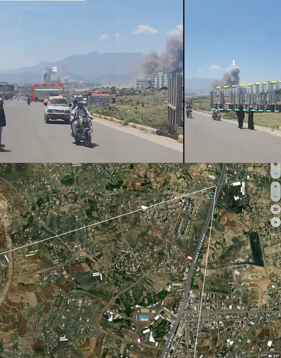
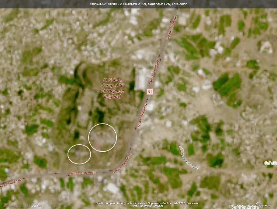
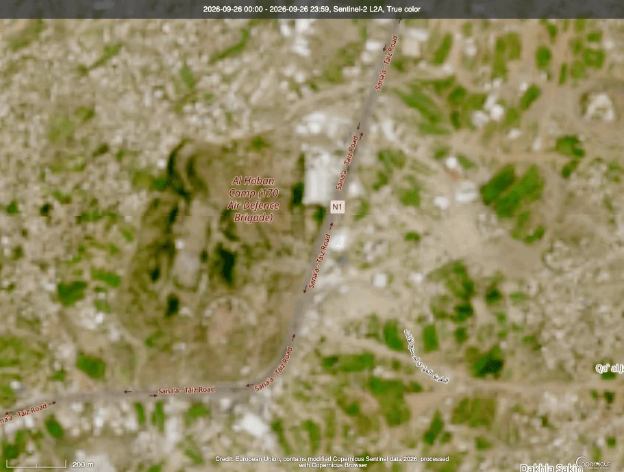
Recent satellite images showed that the camp was affected by the latest attacks. Copernicus Browser comparison of the Sentinel-2 images of 26 and 28 September 2026.
Another video, whose location we also verified, shows the first moments of the strike on the shops with smoke still rising. The area the smoke comes from matches the locations of the commercial shops and warehouses that were hit.
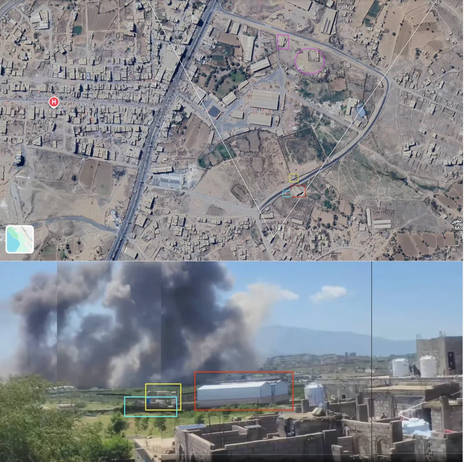
Another video that drew wide engagement showed a different perspective, with sounds claimed to be explosions at an arms depot. We checked the location, and the closest likely matching vantage point lies south of the shops and warehouses that were hit, assuming it was actually filmed in the same area.
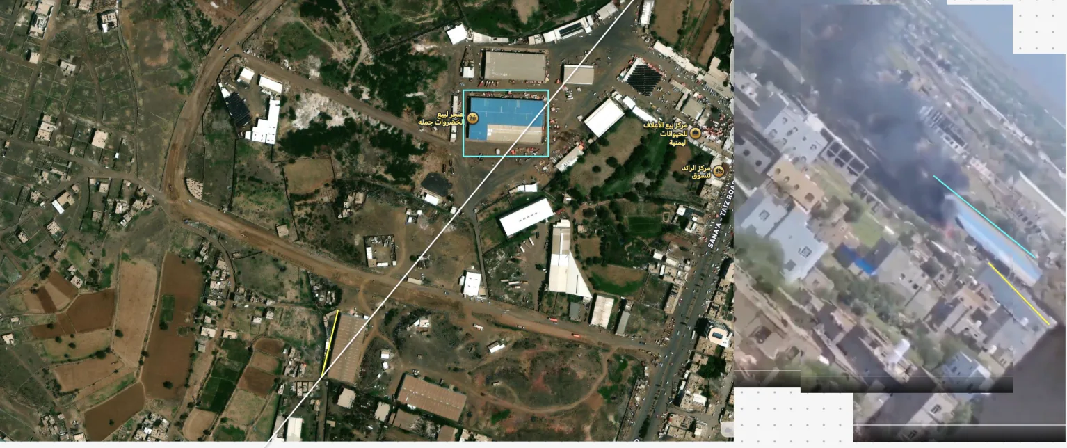
To verify the source of the audio track, we compared it with a second, independent recording of the incident, filmed from a position about 751 metres north of the target site, while the clip's filming position is about 628 metres from it.
Given these distances, the sound of the same explosion should reach the clip's camera first, after about 1.83 seconds, and then the second camera after about 2.19 seconds, a difference of about 358 milliseconds (about 8.6 frames). The frequency signatures of the two recordings should also be close, since the effect of the 123-metre difference in distance is no more than about 1.6 decibels in intensity and about 2.5 decibels in the frequency distribution up to 3 kilohertz.
But analysing the two tracks with Waveform, RMS Peak Detection and Spectrogram did not show this convergence. There is no time offset within ±5 seconds at which the clip's sound matches the reference recording beyond chance, and the highest correlation of the sound-energy envelope did not exceed 0.425. About 92% of the reference recording's energy lies below 300 hertz, as expected for the sound of an explosion heard from a distance, whereas about 63% of the clip's sound energy lies in the 300–3000 hertz band, with a difference in spectral tilt of about 17 decibels, several times what the difference in distance could explain. The clip's sound also carries 30 successive sharp peaks, against a nearly flat envelope in the reference recording, and a sharp, constant frequency cut-off at about 3.4 kilohertz across the whole recording. This is a digital-processing trace matching the telephone voice band, not a product of sound travelling through air, and it does not appear in the reference recording.
This is consistent with the fact that this is the only clip, among the videos we collected on the incident, whose sounds differ from the rest. Unlike the synchronisation test, which is not sufficient on its own, these indicators together suggest that the clip's audio track was replaced or added after filming and does not reflect the event the scene shows, so the sounds circulating with it cannot serve as evidence of explosions at an arms depot.
Explore the audio analysis
Compare the sound of the yementdy clip with the reference recording from Antar al-Halimi’s video, and change the variables to see how they affect the results.
The sound reaches the clip’s camera first because it is closer. If both videos had recorded the same explosion, their audio would show this gap and their frequency signatures would converge: a difference in distance changes the intensity by only about 1.6 dB.
Methodology: Waveform, RMS Peak Detection, Spectrogram and Pearson correlation. Distances use the haversine formula from the coordinates of the two cameras and the target site, and the speed of sound is computed from the temperature.
Legal framework
International humanitarian law prohibits directing attacks at civilian objects, including markets and shops (Rule 7 of the ICRC customary international humanitarian law study). It prohibits indiscriminate attacks (Rule 11) and attacks that may be expected to cause excessive civilian harm in relation to the concrete and direct military advantage anticipated (Rule 14). Even if a camp near the market were proven, the attacking party must still take all feasible precautions, including in the choice of means, methods and timing of attack, to minimise harm to civilians (Rules 15 and 17). The strikes also took place, according to the announced timing, around midday on a Sunday, a working day and a time of activity in a wholesale market.
Conversely, the same law obliges the defending party to avoid locating military objectives within or near densely populated areas (Rule 23) and to take precautions to protect civilians under its control (Rule 22). If what government sources said about the Houthis setting up a camp near the market is true, this in turn raises questions about the group's compliance with these rules. The evidence we gathered does not allow a ruling on any of these questions, which call for an independent investigation.
Conclusion
The available evidence confirms that an airstrike hit a building adjacent to “Al-Mutawakkil Food Stores” on the southern edge of the Taiz Central Market at Mafraq Mawiyah in al-Ta'iziyah district, Taiz governorate, around midday on Sunday 27 September 2026, and that the attack left dead and wounded who appeared in the clips in civilian clothing. Yemeni government forces claimed responsibility for strikes on the area the same day, while the Houthis hold Saudi Arabia responsible.
The evidence does not rule out another military target in the area: satellite images showed damage to the surrounding buildings and warehouses that was probably caused by direct strikes, with smoke columns that kept rising for some time afterwards. But the “camp” account alone does not explain the destruction of a commercial building full of foodstuffs in an active market. Settling the nature of the targets and the casualty toll depends on fieldwork, lists of the victims' names, and independent testimony from the ground.